Saturday, 16 June 2007
Distance 33 km
Duration 8 hours 5 minutes
Ascent 1092 m, descent 1059 m
Map 60 of the TOP100 blue series (now superseded)
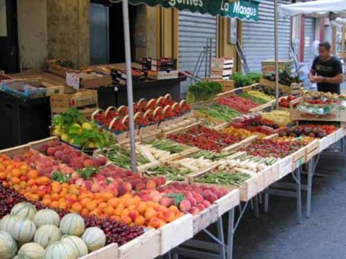
Saturday was market day in Apt, and the village was busy at 7 am, with stall holders setting out their wares and shouting greetings to each other. We had a leisurely coffee amongst the bustle before setting out to find the GR9, which left town to the south. We had to be a bit careful, as there was also the GR92 in this vicinity, and the red and white markers do not discriminate.
The first section was steeply uphill on small roads and then on a track at the back of houses, even steeper.
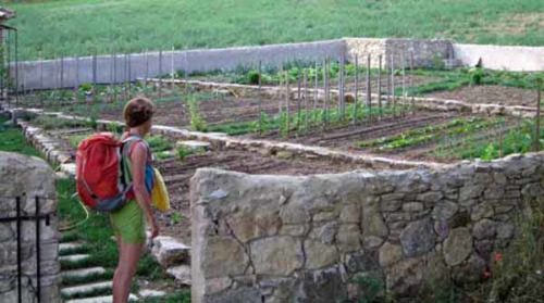
Near Les Tourettes there was a vegetable garden all by itself in the field, built like a fortress with thick stone walls and an iron gate.
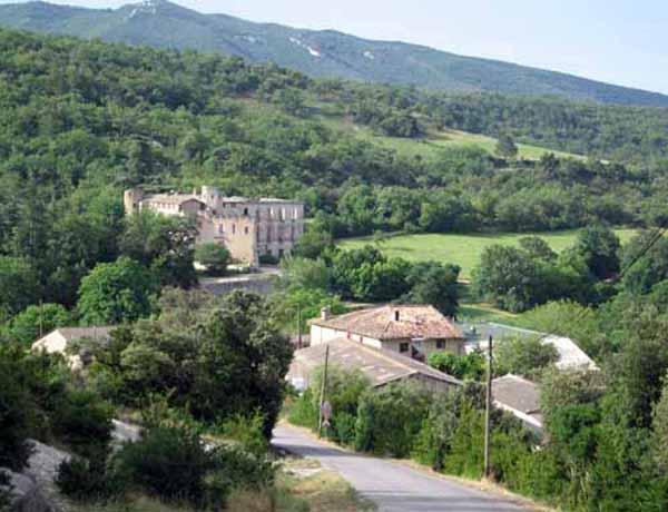
After great exertions we got to a small road that took us to a crossroads at the top, and then down alarmingly towards the brooding château of Buoux. The village itself was up another steep wheel track and down the other side on a series of hairpin bends.
It was a scrappy little place and although it no doubt had charm for its residents, and for well-fed passers-by in cars, for the visiting walker looking for a coffee break it had nothing to offer. It was 9:15.
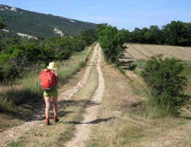
We strode straight through on the GR signs and immediately climbed again, then left the road for a mercifully flat walk on a farm track. A fearsome line of cliffs appeared to our left across a great void and we heard voices from below.
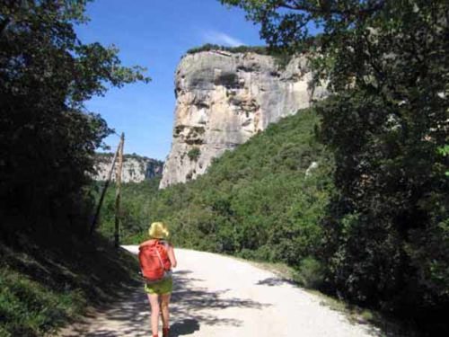
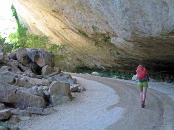
Peering down through the scrub, we could see a clearing far below with a large building surrounded by cars. The path then doubled back along the cliff line, finally making a sharp, rocky descent in a side valley to the floor of the main canyon.
The way was marked with both GR (red and white) and GRP (red and yellow) signs, newly painted and frequent. At the bottom of the gorge there was mass of shrubbery on either side of the river, the Aigebrun.
Somewhere here we missed the GR turn and found ourselves on the GRP only, following the stream down. Since the GRP was not marked on our map, we were not sure where we would end up, but we came out at the chalet that we had seen from above.
There were day-walkers everywhere, parking their cars and setting off up a gated side road. On an information board we saw the GRP going up this side-road, past the Fort of Buoux, to the top of the Grand Luberon, which was where we wanted to go, so we regained our confidence.
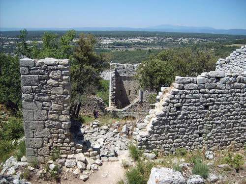
The wheel track was astonishingly steep as far as the Fort. This stronghold, now in ruins, occupies a shelf on the dizzy edge of a cliff and was occupied since prehistoric times up till the seventeenth century, as part of the defences of the trade route over the Luberon.
Originally it was a baume (a natural rock overhang) and was progressively strengthened by ramparts on the outer side. Excavations have found signs of a primitive village, with store rooms, a well, a chapel, graves, even clothing.
Beyond the Fort we were on our own and the wheel track shrank to a narrow path, becoming even steeper and much rougher, as we toiled up and up, with thick vegetation blocking our view. We felt we must be close to the top long before we actually were. Every bend in the track revealed another demoralising climb above us.
Our main problem was that we did not know quite where we would emerge, as we had forgotten that detail on the information board, and also our water was running short.
The GRP signs were still fresh, however, and after an unbelievably long time the undergrowth suddenly gave way to a steep meadow, at the top of which we rejoined the GR, to our great relief.
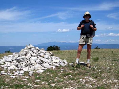
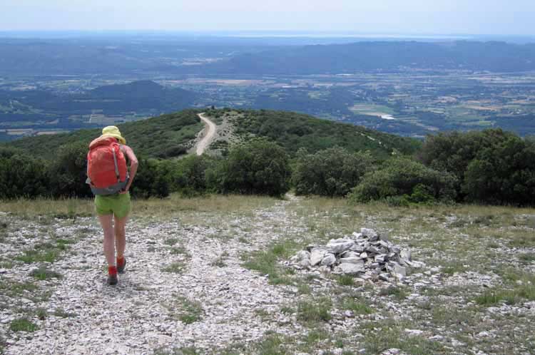
This was the top of the Grand Luberon, and it had turned out much grander than we expected. We had just climbed 1100 metres.
A short descent took us to a patch of soft alpine grass under a small oak tree, and there we lay down for a luxurious lunch of trout, sausage and cheese, with the heel of yesterday’s baguette (we had assumed we would be in Lourmarin in time to get fresh bread for lunch).
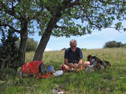
The great fertile plain of the Durance extended to our south, laid out like a picnic blanket, with all the enticements of civilisation, comfort and above all water.
Mont Sainte-Victoire, beloved of Cézanne, was a blue pimple in the distance.
We hurried down a stony white road (crossed out on the map, which meant closed to vehicles), and when the GR branched off onto a plunging track, we decided to stay on the road, as it looked like the quickest way to Lourmarin and we felt too tired for any more adventures. Whether this was wise we still do not know.
Certainly it was a long, thirsty slog down the road in the afternoon sun (two hours), with some frustrating zig-zags near the bottom. The good part was that it was all downhill and the air was full of the scent of rosemary and thyme growing on the roadside.
When we met a pair of walkers out for a stroll, we knew we did not have much further to go and soon came out onto a flat farm road. We drank the last drops of our water and set off for the final push into the village.
A little way along we came to a cherry orchard and with the desperation of great thirst we rushed over and picked handfuls of the glossy fruit, stuffing them into our mouths and letting the juice run down our parched throats.

The pleasure was all the more poignant because of our previous suffering, which is a constant theme in long-distance walking – intense emotions of both kinds.
Remarkably revived by this happy chance, we had only a short way to go to reach the village (4:15 pm). Tourists were strolling about and Saturday afternoon sports were in progress. We found a café and sat down next to a fountain, where we had a litre of water and two lovely coffees.
The camping ground was less than a kilometre away, on the road to Vaugines. Keith had a swim in the pool when we had established ourselves.
There was time only for a shower and a brief rest before the thought of dinner tempted us back to the village.
Before eating we made a brief circuit of the streets, which wind around a central knoll. The townspeople are very proud of the fact that Albert Camus lived and worked here. There are two churches and some ruins, but the château is slightly out of the village.
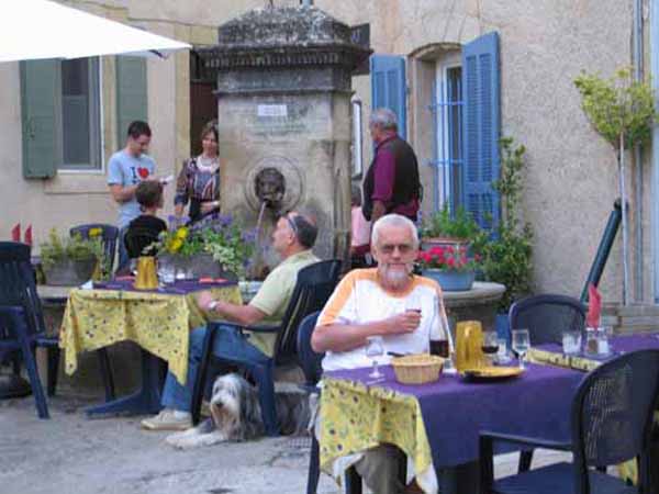
As we came down from the knoll, we saw a restaurant with tables spilling out across the street. We quickly installed ourselves near a fountain (it was a fountain sort of town) and had a wonderful meal, all the better for the exertions that had preceded it.
We began with oeufs mayonniases and a tomato salad, both resting on beds of lettuce, then we had fillet steak with big fat chips, and finally a chocolate mousse for Keith and a slice of goat’s cheese for me. The wine flowed, the bread disappeared steadily and we were very happy.