Sunday, 20 June 2004
Distance 36 km
Duration 7 hours 30 minutes
158 m, descent 143 m
Map 64 of the TOP 100 blue series (now superseded)
Topoguide Le Chemin d’Arles (blue cover)
It was not raining when we left, although it looked capable of it.
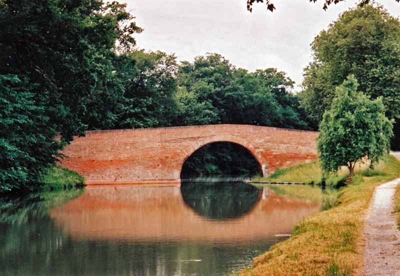
To get back to the canal we had to walk a couple of kilometres on the road and take the first turn right. On this exact corner, a merciful providence had placed a bar, which was full of old geysers starting the day as they meant to continue, propping up the counter with a glass in hand.
They were not used to being visited by pedestrians from Australia, and found it highly diverting. The only thing they knew about Australia was that we had a very good Rugby team and by the time they had finished congratulating us, we almost felt that we had trained the team ourselves.
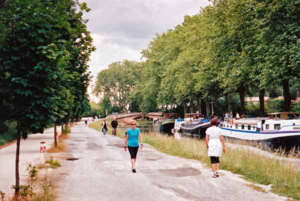
This reviving coffee break took us all the way along the canal into Toulouse. The closer we got to the city, the greater the crush of Sunday morning activity – cyclists, joggers, roller-bladers, people pushing prams – bobbing and swaying around us.
The canal was lined with long boats painted in carnival colours, with pot plants and all the trappings of permanent homes.
On the other side of the towpath there were factories, from one of which emerged a gargantuan object on a low-loader, which turned out to be a satellite on its way to Austria.
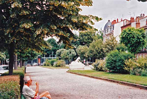
We were now well into town so we turned off into the streets and had our lunch in a strip of parkland lined with fashionable houses, beside the Botanical Gardens. We were then looking for our second coffee of the day but we were not in a café area.
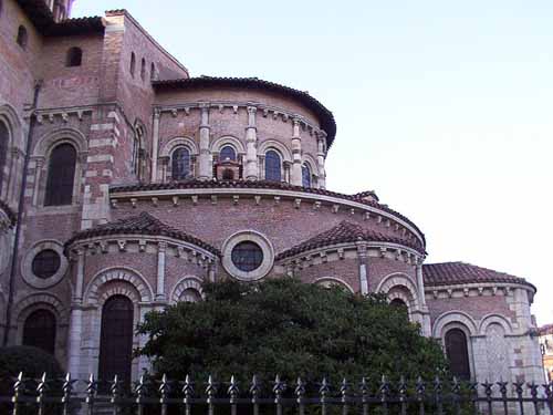
We needed to find the Place du Capitole, and on the way we tripped over the cathedral of Saint-Étienne, an ungainly red brick mass resulting from the merging of two incomplete thirteenth century churches on different alignments. Inside it was even more clumsy, although undeniably impressive.
The next thing we came to was the Office of Tourism, where we got information about internet cafés and the nearest camping ground to the west, at Saint-Martin-du-Touch.
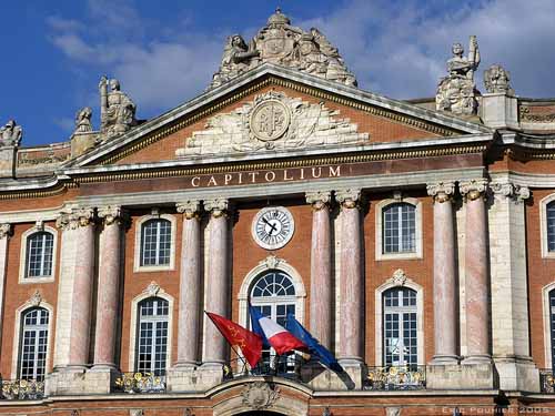
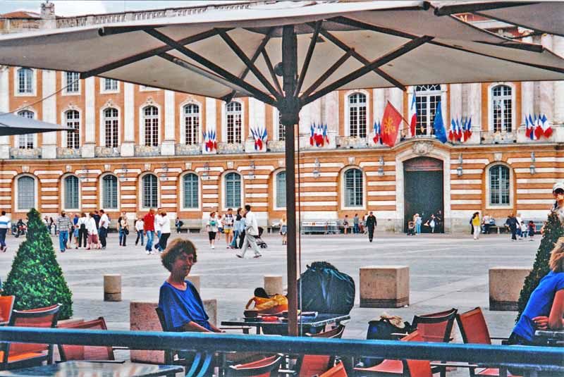
While we drank our breathtakingly expensive coffee in the Place du Capitole (which is the size of a football field), we composed an email, which we finally managed to send at the third attempt, the first two places being closed.
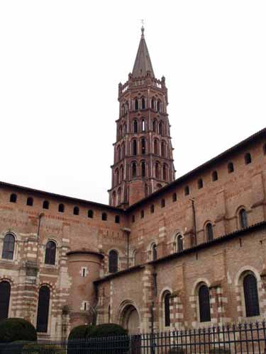
Much as we are opposed to mixing walking and tourism, we did deviate slightly to see the basilica of Saint-Sernin, the biggest Romanesque church in the history of the universe, apart from Cluny. Like the cathedral, it was jammed in awkwardly amongst other buildings, but its pagoda-like tower could be seen from afar.
It was here that Simon de Montfort, the sadistic leader of the anti-Albigensian campaign, was killed in 1218 by a stone dropped from the roof by a group of women – the sort of resourcefulness that gives women a good name.
All we had to do for the rest of the day was to walk the four or five kilometres to the camping ground recommended by the Office of Tourism. We were on the GR653 and had no trouble following the signs, first over the river Garonne, then through the usual grimy outskirts.
These were uglier and more extensive than anything we had seen before. More and more we were hemmed in by autoroutes, but we persevered until we were at the Camping. The gate was shut and carried a “Complet” sign, ominously like the squalid shanty-town at Ayguesvives, and so it turned out. The place was a dormitory for low-paid workers, not a camping ground, and had obviously been like that for years, while the Office of Tourism blithely continued to recommend it.
With difficulty we struggled westward, following the description in the Topoguide, through a ghastly industrial maze. It was only when we got to the satellite town of Colomiers (where they make nose-cones for jumbo jets) that we read “the pilgrim may now descend from the bus…” This explained why there had been no GR marks for the last few miles. By now we were really out of sorts.
Colomiers consisted of a forest of sky-high apartment blocks, recently built for the workers; apparently the place has grown from 400 to 26,000 in a few decades. Nevertheless the old village survives in the centre, marked by a church and a pretty little park.
A woman stopped us to say that she had walked part of the pilgrimage, and she offerred to drive us to the next town, but we declined, although it was tempting. Some old chaps playing boules told us there was a restaurant open beside the church, which turned out not to be the case. The only thing open was a take-away pizzeria.
We were getting close to the end of our tether. A quick tour of the park showed that it had no discreet nooks for stranded pilgrims to sleep in. We decided to have a pizza and then walk off and see what we came to.
The interior of the pizza shop was warm and pleasant and we sat there with our pizzas on our knees, drinking wine out of the plastic glasses we had souvenired from the hotel at Saint-Félix. It was quite convivial with the two sweating young pizza-makers and a passing parade of customers. We stayed there until they closed at 9 pm, then, much restored, set off into the gloom.
There was just enough daylight to read the complicated instructions in the Topoguide and get onto the Pibrac road.
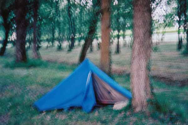
A little way along it we saw a small wood of pines, surrounded by streets and houses but already dark within.
Hardly hesitating, we slipped into its depths, found a flat place, put up the tent on the newly-mown grass and collapsed. We could only hope that none of the people or dogs that we could hear around us would come any closer.
Previous day: Avignonet-Lauragais to Deyme