Wednesday, 13 June 2007
Distance 30 km
Duration 5 hours 45 minutes
Ascent 568 m, descent 612 m
TopoGuide (Ref 401) la Haute Provence par les Gorges du Verdon
Map 60 of the TOP 100 blue series (now superseded)
At 7 am, our ribs lined with muesli and peaches (well washed after their roll down the street), we left Manosque on a small road and headed towards Pierrevert, where we hoped to pick up the GR4 again.
It worked brilliantly and we were at the gate of Pierrevert by 7:30. This great portal was demolished by an earthquake in 1701, but has been rebuilt.
The village perches on a hilltop and the remains of its ramparts can still be seen, although the château was largely destroyed in the Revolution.
Nearby was an official election display board. Electoral advertising is heavily controlled in France and is only permitted on special boards, with a single panel for each candidate. The one we liked best had a two-pronged policy – the withdrawal of France from the EU and the reopening of the maternity hospital at Sisteron.
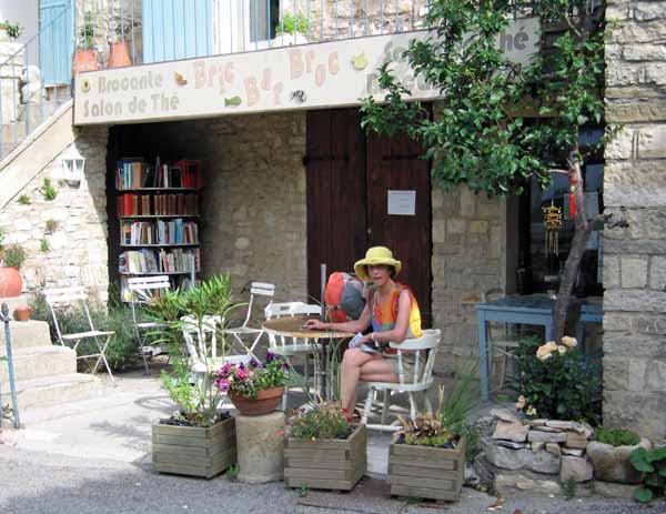
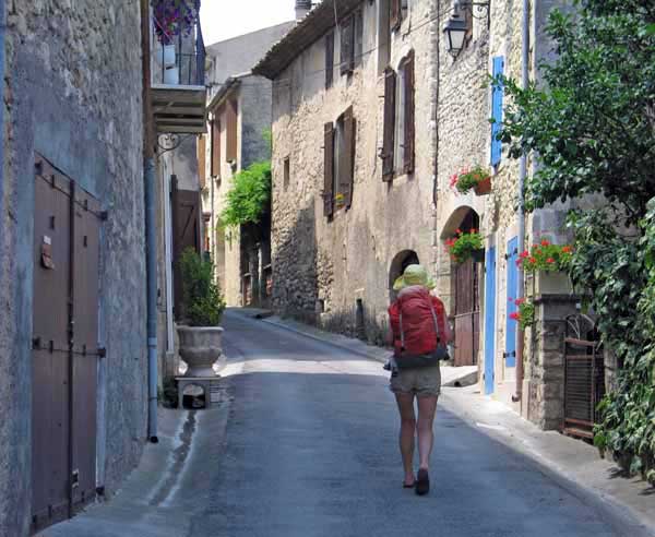
A pleasant surprise at Pierrevert was a bar, not mentioned in the Topoguide, set among the lovely old houses. We enjoyed an unexpected second breakfast there, then found the GR plunging off the rise at the other end of town. It was a well-marked track, and it needed to be, with all the twists and turns and snatches of road that it entailed.
Only once did we miss the way, after the bridge at la Done, where the red and white sign was so rusted that it was almost unreadable, but we only went a few hundred metres on the D6 before realising our mistake.
We went back and turned off onto a tiny tarred track, just wide enough for a car, at first through vines and then rising in a pine forest, where we stopped for a swig of water. A carload of hearty looking people waved as they drove past.
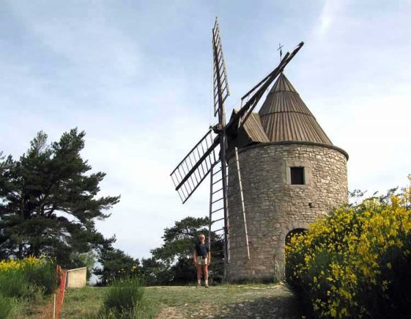
At length we arrived at the pretty hamlet of Montfuron, in a clearing at a height of 650 metres (Manosque is at about 300m). There was a bar there, but it only opened in the afternoons. The main attraction of the place was the restored windmill, damaged by a mini-tornado in 2006 but still standing.
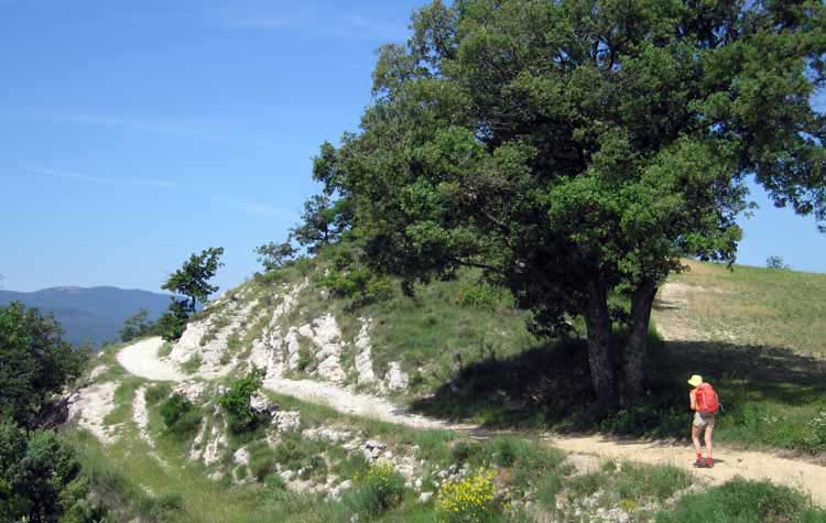
The little tar road continued to an intersection, where we took the middle of three ways, a gravel road. Soon after we came to a second crossroads and turned left along the D956 for a short distance, then parted company with the road altogether and took a white, stony path, typically Provençal, clinging to the knife-edged ridge.
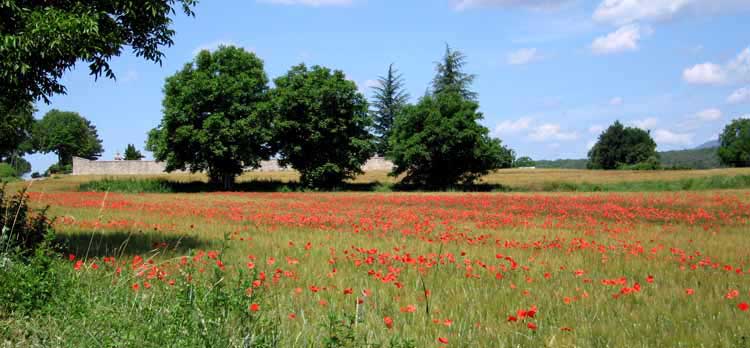
On either side the ground fell away towards farmland, with fields of poppies, dark pines and a distant view of the blue mass of the Grand Luberon.
The track itself was level, the air was fresh and the scenery was lovely. We met a surprising number of other walkers as we meandered along, including the hearty carload that had passed us lower down.
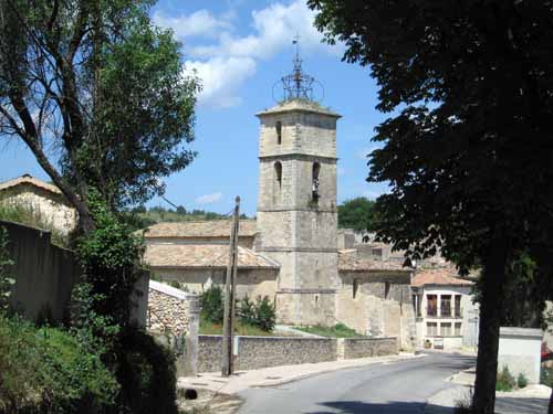
Beyond the village of Montjustin, which we skirted, we gradually descended from the ridge and merged with a small road which led us into Céreste.
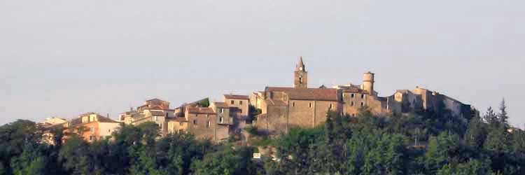
Looked down on from a distance, the village seemed delightful, with its church tower rising from a mass of old roofs, but at close quarters its charms were reduced by the fact that the main street was being dug up and repaved, so that all the shops and bars along it had withdrawn indoors.
At the Office of Tourism we were told that the nearest camping ground was three kilometres further on, and the gîte a similar distance back, so we retired to a stuffy, smoky bar to decide what to do.
As the possibility of dining at the camping ground was remote, the situation called for a substantial lunch in town instead.
The only establishment not affected by the roadworks was the Logis de France hotel in the side street, from the terrace of which a cheerful babble could be heard.
We were lucky to get the last table out of doors, and set about the enjoyable business of eating.
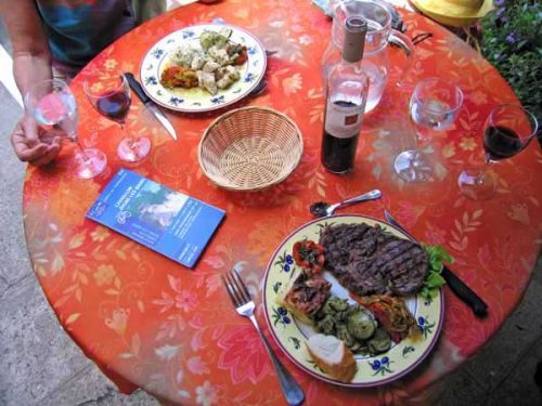
It was the second day in a row that we had dined at midday, and we ordered, as we had yesterday, a menu du jour and a plat. We shared the generous salad composée, as well as the two main dishes, a grilled steak and a turkey leg.
I even sampled the monumental cream confection that finished the menu, a Dame Blanche. There was no house wine at this genteel place, so we had a half-litre bottle of la Toque red.
The walk out to the camping ground took an hour and as usual we started to wonder whether we would ever find it, and whether it would be open, but in due course it appeared, a very simple place in a small wood surrounded by farms, with a dirt track winding through it. There was a shower block in the middle and various tents and caravans scattered about under the trees.
By this time I was feeling queasy, not from the lunch but from the same thing that had afflicted Keith a couple of days before. I spent the afternoon curled up in a tight ball trying to relieve my stomach cramps.
We had no dinner, but we did not need any. The only thing we did in the evening was stroll up to the farm at the top to pay the camping fee (€8.20) and have a chat with the jovial farmer.