Friday, 20 June 2003
Distance 34 km
Duration 7 hours 25 minutes
Ascent 1576 m, descent 512 m
Map 69 of the TOP 100 blue series (now superseded)
Topoguide (ref. 1086) Pyrénées Occidentales
The day started well. We were on the move by 7 am, with a steep pull up the road causing us no trouble. The trouble began further up, with an intersection devoid of GR markings, except for a faint old one on a stone, which we decided to follow.
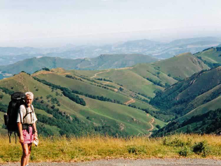
This led us eventually to the real GR as it emerged from a side path. We must have been on an older route. There followed a delightful walk through farmland, some of it appallingly steep, but our little road kept its gentle uphill gradient.
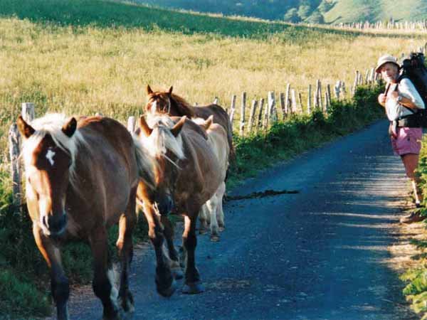
A family of wild horses – the heavy-footed, blonde-maned creatures called pottoks – confronted us at one point, but we passed each other peacefully.
Leaving the road, the GR scrambled up a stony chute to Ithurramburu and we found ourselves looking into a deep, expansive hollow.
A farm track led down into it and a small bitumen road continued around the crest. Needless to say, there were no more GR signs.
After long deliberation, and full of doubt, we took the road. This was wrong, but we did not realise it until we had walked miles, by which time even we could see we were not where we should have been.
There were no trees, no traffic, no houses except a couple of abandoned hovels. At last we saw a small van parked beside the road, the driver just getting in to drive away. With undignified haste we stumbled towards him, shouting that we were lost.
As soon as he pointed out where we were, it all became clear – the road we were on was marked as just a dotted line on the map. The only trouble was how to get back on the GR, which we could see below us down a fearsome drop.
In the end, the best idea seemed to be to continue on the road until it reconnected with the GR at the Col d’Irau.
This added another five km of thankless trudging to the day, but at least we had maintained our altitude, unlike the GR.
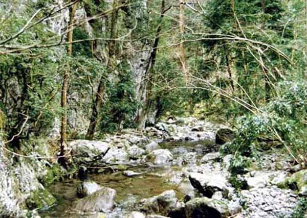
At the Col d’Irau we plunged gratefully into the forest and had lunch on a grassy bank, where a crystal stream tumbled into a pool. Pottoks were grazing nearby.
Afterwards we set off again on the road, now shady and pleasant, but a couple of kilometres further on, Keith found that he had lost his glasses – they must have slipped off when he drank from the pool.
Thoroughly demoralised, we threw our packs into a culvert and hurried back, finding the glasses immediately. It was turning out a long day.
We were taking the road instead of the GR here, because it was shorter, shadier and had no cars on it.
At the place where we reconnected with the track, there was a small shining lake and a cafe, packed with lunchtime diners.
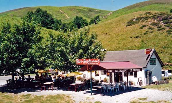
After almost 30 km of hard walking, we thought it was a mirage, but rushed towards it anyway. It says much for the standard of the coffee there that even in our pitiful state, we found it atrocious. Nevertheless it was invigorating and sitting under an umbrella with our boots off worked wonders.
From here on we followed the GR religiously. The climb was steep and stony, amongst the grand old trees of the forest of Iraty. We crossed a saddle and descended to a road with another little lake, where people were swimming. It was roasting hot by now.
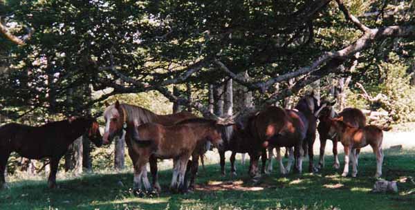
Then an even more ferocious climb in zig-zags took us up to a ridge. We were so hot that we had to stop in the shade, which we shared wth a group of pottoks. With our last ounces of strength we made it to the road and followed it up to the ski resort of col Bagargiak, our destination for the day.
Few places are drearier than ski resorts in the off-season. All the chalets were deserted, sitting stranded on the muddy ground like boats at low tide. At the information centre, we were told that the nearest camping ground was several kilometres down the road and that camping was forbidden at the gîte. We got the key for the gîte (paying extra for showers – it was that sort of place) and found that we had company this time – another lone Englishman, this one thin and elderly, a retired school inspector named David.
The restaurant was closed for renovations, although the bar was operating. I went back to the information centre and complained that we had no food and would have to starve for the night, so the man made a phone call and announced that the dining room would open just for us.
Shortly after this, Richard stumped in, purple-face and exhausted, so there were four of us for dinner, and we made sure of our welcome by going up to the bar beforehand for drinks. Basque beer is called either Exi or Oldarki, and is hoppy and strong and good.
The dinner was a strange affair. We strongly suspected that it was cooked by the waiter. After the obligatory garbure, we had fried eggs, bacon, sausages and chips – as Richard said, the best English breakfast he had eaten abroad.
Then we retired to our tiny cubicles at the gîte. David and Richard have met before on the track, and David warned us darkly that Richard was a prize snorer, but we heard nothing.