Thursday, 14 June 2007
Distance 23 km
Duration 5 hours 15 minutes
Ascent 450 m, descent 480 m
Topoguide (Ref 401) la Haute Provence par les Gorges du Verdon
Map 60 of the TOP100 blue series (now superseded)
In the morning my stomach pangs had vanished as though they had never been. We marched off at a brisk pace and were back at the highway (the N100) by 7 am. There was no GR in these parts, as the GR4 had gone north from Céreste, so we walked along the road for a little way until we came to the turn-off to Viens, our destination.
Rather than follow the bitumen all the way, we decided to risk a short-cut on what looked like a track on the map, between Fouix and les Faysses. At the end of the little car road was a farmhouse, but no sign of the track until we trespassed our way through the yard and found some overgrown wheel ruts heading in the direction we wanted.
We rose steadily from the valley, slightly bothered by a large zig-zag not shown on the map, and came out on the top of the ridge, in a flowery meadow in which all trace of the wheel track had been erased, except for a faint flattening which we followed until it became distinct again.
Presently our way was barred by bundle of dry branches tied up with electrical cable, and a sign saying No Entry – Private Property.
Of course we ignored this and pressed on, but there were several other gates and barriers to get over, so that we were a bit worried about what sort of reception we would get at les Faysses. In the event there was nobody in sight at the farm, not even a dog, and we stepped out onto the public road with relief.
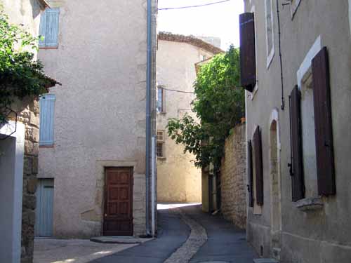
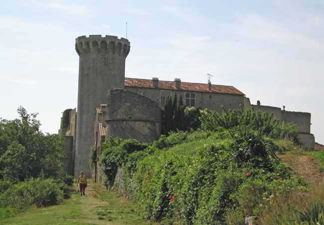
A few kilometres further on we arrived at Viens, a little gem of a village on a steep knoll, with a château at the top. While we were buying pastries, the baker told us there was a bar in the town, but we wandered through the lanes and squares without finding it.
Emerging from this picturesque maze, we met a couple of other walkers, who turned out to be Dutch. They had been dropped off by their wives to walk to Saint-Saturnin and had just had coffee, so they pointed us to the café, which was at the bottom of the village, on a corner.
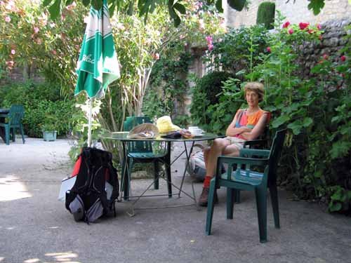
We ordered our coffees at a cramped, over-sunny table on the kerb, but were then shown into a garden at the back, behind an old wall. Despite the pleasant shady surroundings, my coffee did not have its usual savour, as my stomach was still recovering from yesterday’s upset.
At the top of the village, where the château looks out over an expansive valley, we rejoined the GR (no longer the GR4, but just as good). A burly man with a whipper-snipper was mowing the track and gave us exhaustive instructions on how to get to Rustrel, which was nice of him, but we only had to follow the markers.
At first we descended beside the D33 and then turned onto a well-signposted forestry road which meandered along high above the valley in a forest of half-dead trees.
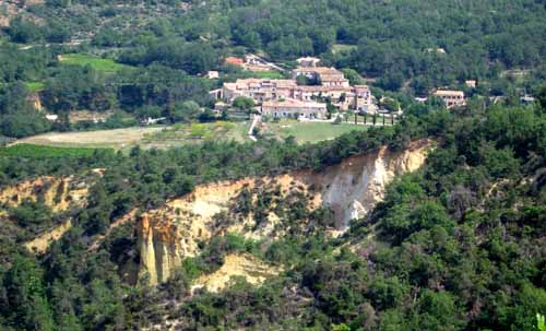
After a while we met a tar road going down to Gintrac, a little place which looked far too close to the crumbling edge of a cliff of ochre.
We left the road on another dirt track and soon came to a cherry orchard where someone was picking the crop, but it was not the farmer, only a passer-by helping herself rather generously. When she drove off with her large basket of stolen fruit, we went down and collected a handful for breakfast.
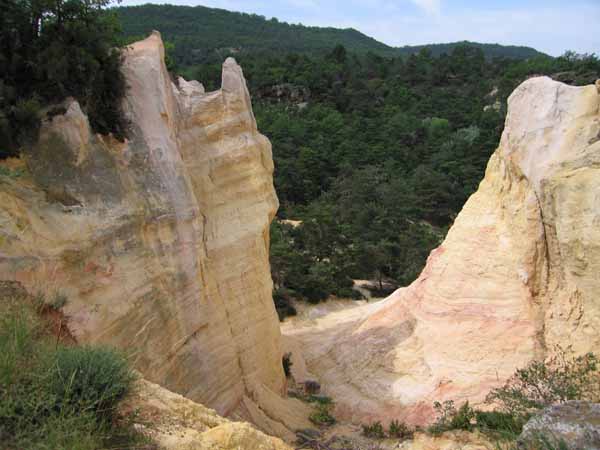
Just past the orchard we came to a fantastic landscape of ochre canyons, eroded into spines and turrets, in all the colours from cream to mustard to orange and dark red.
A lot of unfit-looking people were puffing up the track, and as we descended we found a large pay-parking area full of buses and cars. We were at the “Colorado Française”.
We felt that we had almost arrived in Rustrel, but it was still a long way and in my weakened condition I began to fade, but Keith gallantly took my pack for the last kilometre. We got the second-last baguette in the shop and sat down at a bar in the centre of the tiny village, where there were also two restaurants.
The Dutch walkers we had met in Viens were having lunch at an adjoining table. We talked about walking and the state of the world. They seemed remarkably well-informed about the Australian political scene and we hoped that we would not be called upon to give an opinion on Dutch politics.
In the square there was an information board with a map of the district, showing the camping ground two or three kilometres away on the river, not far from a ruined chapel. It was too far to come back to the village for dinner, but luckily there was a restaurant indicated at the camping ground.
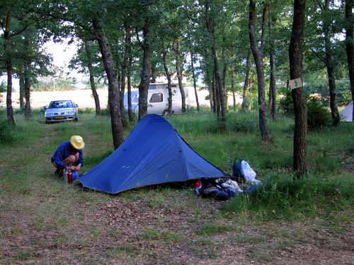
We walked down without difficulty and installed ourselves, although there was nobody about, only some cars, a few tents and a line of neat little cabins amongst the trees.
Keith had a solitary lunch, then we had showers and a sleep. Later Keith went to pay and the man advised him to book a table at the restaurant, which hardly seemed necessary, but he did.
We expected to be the only diners, but when we arrived there was quite a crowd on the terrace, and more people inside. Smoke rose, not only from the numerous French cigarettes around us, but also from the pizza oven, built against a natural ochre chimney.
Keith had a fiery pizza of chorizo and anchovies and I had pasta pistou, rather plain but suitable for my delicate innards.