Each year since 2002 Jenny has written day-by-day narratives of our walking trips in France. Below are brief summaries of each, with an accompanying map.
Clicking the various links on this page will take you to a year’s diary, a short walk or a pilgrimage.
Having nineteen maps on this page means it could load a little slowly, so some patience may be required.
2002 Walk
A daily diary of our 25-day, 580 km walk.
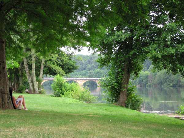
We started with a 6-day walk in High Provence from St-André-les-Alpes by way of Castellane and Moustiers-Sainte-Marie to Gréoux-les-Bains.
Then we caught the train to le Puy-en-Velay and walked for 19 days on the pilgrim Way of Le Puy (GR65), also known as the Way of St James.
We made a deviation down the river Célé on the GR651, from Béduer to Saint-Cirq-Lapopie, then rejoined the main Pilgrim’s Way at Cahors and went on to Moissac.
You can also see this map using Google Earth and take a virtual flight along our route.
2003 Walk
A daily diary of our 34-day, 820 km walk from Martel to Pau.
We started with a 5-day circuit in the Upper Dordogne from Martel, via Collonges-la-Rouge, Beaulieu and Carennac, to Rocamadour.
We then made our way to Gourdon and Lauzerte, to join the pilgrim Way of Le Puy (GR65), or the Way of St James, which we followed as far as St-Jean-Pied-de-Port.
The final section was along the Pyrénnées on the GR10 to the valley of Somport, then down the Aspe River to Oloron-Saint-Marie and finally Pau.
You can also see this map using Google Earth and take a virtual flight along our route.
2004 Walk
A daily diary of our 37-day, 840 km walk.
We began with a 5-day walk in Burgundy starting and ending in Beaune. We passed through Savigny-lès-Beaune, Meursault, Santenay and Nolay.
This was followed by a 32-day walk from le Puy-en-Velay through the Cévennes on the Robert Louis Stevenson Trail (GR70), passing over Mont Lozère to Florac.
We then left the GR70, travelling over Mont Aigoual and down via the Cirque de Navacelles to Lodève.
From Lodève we passed through the High Languedoc to Mazamet before joining the pilgrim Way of Arles (GR653) at Dourgne and continuing past Revel to the Canal du Midi and on via Toulouse and Auch to Pau.
You can also see this map using Google Earth and take a virtual flight along our route.
2005 Walk
A daily diary of our 51-day, 1,180 km walk.
We started with a 19-day walk from Blois to Angoulême, exploring the Loire and Cher rivers as far as Tours, and then turning south on the pilgrim’s Way of Tours (GR655) to Angoulême.
This was followed by a 32-day walk in the south-west. From Terrasson we went down the Vézère and Dordogne rivers to Lalinde.
Catching the train back to les Eyzies, we proceeded upstream as far as Souillac, from where we made a loop in the upper Dordogne through Carennac, Beaulieu, Collonges and Martel to Rocamadour.
Then we continued south to the Lot river and the Gorges of the Aveyron, on our way to Albi and finally Revel, close to the Canal du Midi.
You can also see this map using Google Earth and take a virtual flight along our route.
2006 Walk
A daily diary of our 48-day walk, 970 km through Burgundy and down the Loire.
Starting at Cluny, we walked north via Nolay to Autun. From there we continued through the forests of the Morvan, to Vézelay, Chablis and Auxerre.
Turning south, we followed the Yonne River and the Canal du Nivernais to Tannay, then turned west to join the Loire at Cosne-sur-Loire.
For almost the rest of the walk we went downstream on the Loire, past Orléans and Tours to Saumur, before finally running out of time at Saint-Mathurin-sur-Loire. Our only deviation from the river was to Azay-le-Rideau and Chinon.
You can also see this map using Google Earth and take a virtual flight along our route.
2007 Walk
A daily diary of our 42-day, 1,110 km walk from Gréoux-les-Bains to Angoulême.
We started by crossing the Luberon to Avignon, then entered the Cévennes, where we took the Robert Louis Stevenson Trail (GR70) in reverse to Florac.
From there we went down the Gorges of the Tarn to Albi, and took advantage of other rivers – the Aveyron, the Lot, the Dordogne, the Isle and the Dronne – on our zig-zag course to Angoulême.
You can also see this map using Google Earth and take a virtual flight along our route.
2008 Walk
A daily diary of our eight-day, 170 km walk in Provence and the Drôme.
This was the first year that we were seriously affected by a health problem.
We walked from Saint-André-les-Alpes via Digne-les-Bains and Sisteron to Rémuzat, after which Keith’s kidney stone put an end to our walking.
We hired a car in Avignon and drove for 28 days up the eastern side of France, finishing in Reims.
You can also see this map using Google Earth and take a virtual flight along our route.
2009 Walk
A daily diary of our seven-day, 140 km walk on the upper Vézère.
Once again our intentions were cut short by a medical problem, reducing our walk from the hoped-for forty days to only seven.
We started on the Vézère river at Terrasson, the starting point for our downstream walk in 2005, and followed the river in the other direction, past Uzerche and Treignac, to the tiny village of Lacelle.
Here we decided that Jenny’s eye needed attention at home, so we hitch-hiked to Limoges, got the train to Paris and flew back to Austalia.
You can also see this map using Google Earth and take a virtual flight along our route.
2010 Walk
A daily diary of our 30-day, 770 km walk from Cosne-sur-Loire to Auch.
We started by following the Loire upstream (south) using a mixture of levee banks, minor roads and towpaths of the Lateral Canal of the Loire to Fourchambault. We then merged with the Way of Vezelay (GR654) and left the river in favour of the Canal de Berry.
This took us into the old province of Berry, the country of George Sand, with its peaceful fields divided by great hedges, a part of France still relatively unvisited by tourists.
Pressing on into Limousin, passing from one pilgrim church to another, past Limoges and into Périgord, we crossed the Dordogne at Bergerac, the Lot at Castelmoron and the Garonne at Aiguillon.
It was a land of plenty, full of vines and punctuated by bastide villages, relics of the Hundred Years’ War.
You can also see this map using Google Earth and take a virtual flight along our route.
2011 Walk
A daily diary of our 24-day, 500 km walk.
We started with a 12-day walk from Cluny in Burgundy, heading south over the Mountains of the Beaujolais and the Lyonnais to Saint-Étienne, then through the Gorges of the Loire to le Puy-en-Velay.
This was followed by a 12-day walk along the Cher river and the Canal de Berry from Saint-Amand-Montrond to Tours.
You can also see this map using Google Earth and take a virtual flight along our route.
2012 Walk
A daily diary of our 29-day, 700 km walk.
First we walked for 19 days in the south. From Rémuzat we went over the mountains of the Baronnies and then crossed into the Luberon.
Here we joined the pilgrim Way of Arles which took us through Montpellier and on to Lodève, at which point we turned north over the Causse du Larzac, to Millau.
After that we did a 10-day walk in central France, starting from Treignac. The GRs were so muddy after recent rain that we had to walk most of the way to Montluçon on roads.
The last two days were along the Canal de Berry, and we finished at St-Amand-Montrond. We had intended to go further but Keith had a bad leg strain and we decided to stop.
You can also see this map using Google Earth and take a virtual flight along our route.
2013 Walk
A daily diary of our 17-day, 400 km walk.
We started from le Puy-en-Velay in freezing weather and walked for ten days on the Régordane (GR700), an ancient trade route and pilgrimage, which took us down to St-Gilles.
Then from Montpellier, we crossed the hot coastal plain of the Languedoc on an improvised route, more than half of which was the Roman Via Domitia.
The third part of our walk, the Sentier Cathare, we never actually attempted, because of the extreme heat.
Instead we spent two weeks at leisure in a succession of our favourite villages, until it was time for the long flight home to Australia.
You can also see this map using Google Earth and take a virtual flight along our route.
2014 Walk
A daily diary of our 31-day, 670 km walk from Millau to St-Mathurin-sur-Loire.
Because many of our previous walks have been in a south-westerly direction and this one was towards the north-west, we crossed our old tracks several times, as well as a succession of familiar rivers, starting with the Tarn, then the Aveyron, the Lot, the Célé, the Dordogne, the Vézère, the Vienne and the Creuse.
For a few days we were pilgrims again, on the Rocamadour variant of the Way of le Puy that passes over the Causse de Gramat.
When we reached the Vienne river, we followed it for two weeks until it flowed into the Loire, and finished with a short walk down the right bank to our earlier end point at St-Mathurin-sur-Loire.
You can also see this map using Google Earth and take a virtual flight along our route.
2015 Walk
A daily diary of our 33-day, 720 km, four- canal walk.
Our first ten days were in the far south, from Port-la-Nouvelle to Avignonet-Lauragais. We crossed the thinly populated hills of the Corbières, then descended to join the Canal du Midi, on which we passed through many Cathar towns such as Carcassonne and Castelnaudary.
We then took a train to Burgundy. The second part of our walk started in Beaune and soon joined the Canal of Burgundy, which we followed for a week until we got to Tonnerre.
From there we turned west, past Chablis and Auxerre, then through the old region of Puisaye to Rogny-les-Sept-Écluses, where we met the Canal de Briare.
We took this canal down to the Loire. At Gien we left the river and pressed on through the thick forests of the Sologne to our final canal, the Canal de Berry, which we followed for the last four days, from Mehun-sur-Yèvre to St-Amand-Montrond.
You can also see this map using Google Earth and take a virtual flight along our route.
2016 Walk
A daily diary of our 26-day, 550 km walk, which was in two parts although we did not plan it that way.
We started walking in Burgundy, setting off from Clamecy on the Canal du Nivernais, and walking south along the canal to its final junction with the lateral canal of the Loire at Decize.
After that our intention was to follow the lateral canal to Digoin, then head east through Macon and Bourg-en-Bresse before crossing the Jura mountains to Geneva, where we would join the Way of Geneva going to le Puy.
However fate had other ideas and we only got as far as Diou, just short of Digoin, when we had to call the whole thing off because of a mysterious leg problem.
Five days later the problem went away (although the mystery remained), so we caught a train to Saint-Julien-en-Genevois, leapfrogging the middle section of our planned walk, and proceeded from there to le Puy at a leisurely pace with no further dramas. Once in le Puy we still had time to spare, so as a last flourish we did a two-day circular outing via St-Paulien.
You can also see this map using Google Earth and take a virtual flight along our route.
2017 Walk
A daily diary of our 33-day, 750 km walk from east to west across France.
Starting close to the Swiss border at St-Julien-en-Genevois, we spent a few days crossing the rugged Jura mountains and then pressed on to the Saône near Pont-de-Vaux.
We followed this river north as far as St-Jean-de-Losne, where we turned onto the Canal of Burgundy and continued beside it to Dijon and on to Pont d’Ouche. There we left the canal and headed south-west via Autun to join the Loire at Digoin.
The rest of the walk was generally westward, through rich agricultural land punctuated by classic small towns such as St-Pourçain-sur-Sioule and Hérisson.
When we reached the Canal de Berry at Vallon-en-Sully, the weather was very hot and we decided to have a break in St-Amand-Montrond, a town that we had stayed in before and loved. It was a short train ride away and we had two nights there, eating, sleeping and reading.
Back on the track, we arrived at la Châtre, the end of our walk, and then made our way by bus and train to another favourite town, Bléré, near Tours, to enjoy a second relaxing little holiday before the ordeal of the plane flight back to Australia.
You can also see this map using Google Earth and take a virtual flight along our route.
2018 Walk
A daily diary of our month-long walk down the valley of the Allier and along the Canal of Burgundy, which covered almost 700 km.
We began, as often before, in le Puy-en-Velay, and went north and west for three days until we reached the Allier, a grand river winding tortuously through the mountains.
For the next five days we followed the river on its northerly descent, but after that we were forced to zig-zag widely to left and right, in order to find camping grounds and villages with bars and restaurants, comfort-loving creatures that we are.
We eventually rejoined the Allier and a day later arrived in Moulins. From there we diverged once again from the river, rejoining it after four days, just in time to say a last goodbye as it disappeared into the Loire near Nevers.
For the next week we did a reverse pilgrimage on the Way of Vézelay, and continued to Avallon. A short hop by train and bus took us to Tonnerre, from where we walked along the Canal of Burgundy to its end, and then looped back to Auxerre. After a celebratory dinner, we took the train to Paris, camped one night at the ever-reliable camping ground there, and flew home.
You can also see this map using Google Earth and take a virtual flight along our route.
2019 Walk
A daily diary of our 15-day, 350 km walk from Gannat to Lacapelle-Marival.
The aim of this year’s walk was to fill a gap at the centre of the tangled web that was the map of our previous walks. This gap consisted largely of the elevated rural area of the Auvergne, with its spectacular volcanic plugs and multitude of ski stations, neither of which we saw in the event, as the walking tracks in that area were very few, and the roads very big.
Instead we followed a lovely little river, the Sioule, upstream for a few days until it petered out, then crossed the watershed and began descending into the valley of the Dordogne. There were plenty of ups and downs along the way until we finally joined this famous river and walked beside it to Beaulieu-sur-Dordogne.
At this point the weather changed from cool and showery to roasting hot, with the highest temperatures ever recorded in France. Although we made two attempts to continue, in the end we had to admit that it was not possible to keep walking in forty degrees of heat.
Our intention had been to walk for 35 days and we had done less than half of that, but luckily we had done the most important part, the great crossing of the Auvergne.
You can also see this map using Google Earth and take a virtual flight along our route.
2023 Walk
A daily diary of our 10-day, much-truncated walk in the south of France, covering slightly less than 200 kilometres.
It was intended as a walk down the Durance river and beyond, but in the event we hardly saw the Durance except to cross it once or twice. We started earlier than normal, as we were determined to avoid the unbearable heat of our last walk, but May was uncommonly cold and wet in Provence and the result was that we often walked in raincoats and wet boots.
Some camping grounds were flooded and others refused to accept tents – this is the modern way, we were told – with the result that we had to stay in hotels more than usual.
It rained every day except one, but not continuously, which is why the photos do not look as dismal as it often was. Nevertheless we enjoyed the scenery – the vineyards, the olive groves, the villages, the mountains (especially the Luberon) and the spring flowers that were blooming everywhere.
When we had difficulties, we were helped magnificently by many local people, and we are very grateful for that. In the end we had to abandon our plans because Keith badly twisted his knee and we feared that it was serious (it wasn’t, as it turned out).
You can also see this map using Google Earth and take a virtual flight along our route.