
France is a paradise for walkers, with a vast network of walking tracks, marked with distinctive colours and symbols.
Long-distance tracks across France are called Grandes Randonnées (GRs), whereas tracks that loop around through a particular area are called Grandes Randonnées du Pays (GRPs), and shorter day walks are called Promenades et Randonnées (PRs).
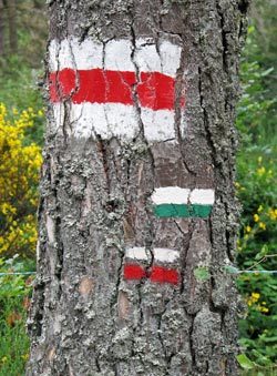
Different colours are used for these three types of walks – red and white for GRs, red and yellow for GRPs and yellow for PRs – and there are three symbols: “straight-ahead”, “turn” and “wrong direction – go back!”. A wide variety of other colours are used for local walks.


The map below is very useful when choosing a walk, as it shows all the GRs and GRPs.
When we discovered this map (which we have greatly modified to make it more walker-friendly), it was a revelation, and we wished that such a map had existed in 2002 when we first started walking in France.
This map is big, so it is best viewed on a desktop computer, but even then, it can be slow to load – it may take up to 60 seconds, depending on your internet connection and device. On smaller devices – because of its size – it may not even load at all.
After it has loaded, click the box icon at the top left of the map. You will see two lists: one for GRs and the other for GRPs. To highlight a GR or GRP, click a route on one of the two lists.
You can see – for example, from the route of the GR4 – that following a GR is not always the best way to get from A to B. For this reason, we often make our own way, incorporating GRs but not religiously sticking to them.
A good website for general information about most GRs and GRPs is GR-Infos.

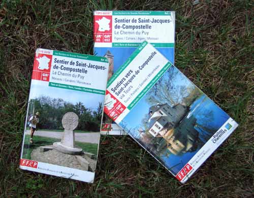
The association of French walking clubs, the Fédération Française de la Randonnée Pédestre (FFRP), publishes very useful guides (topoguides) for many of the GRs and GRPs.
They also publish topoguides of day walks (PRs); each of these topoguides contain all the PRs for a particular department or area.
Click the following links to the FFRP boutique to purchase either GR and GRP topoguides or PR topoguides.
The scale of the maps is 1:50,000, i.e. 2 cm = 1 km.
They are in French but are quite easy to follow, even for non-French speakers.
All topoguides follow the same format – on the left page is a map and on the right page is a description of the track, with information about the services available in each of the villages that the track passes through.

However, they do get out of date rather quickly and some new editions of older guides don’t seem to have any fresh information in them. For example, we used the GR7 topoguide “Traversée du Haut-Languedoc” in June 2004.
Our copy, the ninth edition, was published in July 2003, only a few months earlier, and was hopelessly out-of-date! We now try to use only very recently published first editions.
Importantly, not all GRs and GRPs have a topoguide. If there is no topoguide for your chosen walk, you can use TOP 100 maps, published by the Institut Géographique National (IGN). The scale of these maps is 1:100,000, which is 1 cm = 1 km.
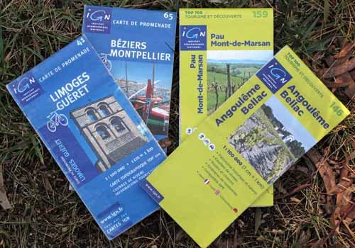
TOP100 maps are designed for walkers and cyclists, and show all the GRs, GRPs and bike paths. However, if you are not following a GR or GRP, their lack of detail results in a lot of unnecessary road walking.
Since 2010, a revised series of TOP100 maps have appeared. These have a different numbering system and unfortunately, their borders do not coincide with the old series.
The best maps of all are the IGN TOP25 series, with a scale of 1:25,000, which is 4 cm = 1 km. On these, all marked walking tracks, camping grounds and even the tiniest paths are shown. The drawback is that you would need a huge stack of them for any reasonably long walk.
Click the following link to the FFRP boutique to purchase TOP100, TOP50 and TOP25 maps
Also, they are all available, together with all the topoguides, in the IGN shop in Paris, at 73 avenue de Paris 94165 Sain-Mandé which is well worth a visit.
In the provinces, the village newsagency (presse) usually has a selection of TOP100 and TOP25 maps of the local area, plus some topoguides of GRs, GRPs and PRs.
Alternatively, if you prefer electronic maps, there are apps available that display TOP100 and TOP25 maps on your mobile phone.
We used to carry TOP100 maps, but now we make our own strip maps before we leave home. We get a preliminary walking route using Google Maps, and then refine it by superimposing it on the TOP25 Géoportail map (the French equivalent of Google Maps), which has more detail.
We set off with about 100 double-sided A4 pages of these strip maps. This sounds a lot, but it is only the weight of six TOP25 maps (about 0.5kg), whereas we would need at least 25 of them to cover the same distance.
These strip maps have been so successful that we would never go back to using commercial maps again.
As an example, here is the Géoportail map we made showing our 2018 route, from which we made our strip maps for that year.
Furthermore, we discard them as we go along, and so lighten our load.
For those who are interested, we have written a full description of how we make our homemade maps.
People who don’t want to carry paper maps can access their maps on their phones if they have a paid subscription to the IGN Outdoors App.
We much prefer paper maps, but we have downloaded the Organic Maps app (which are offline maps) onto our iPhones – very useful when we find ourselves having to go off our very narrow homemade maps. For France, these maps are arranged by department.
Organic Maps seems to be as accurate as the IGN TOP25 maps.
Another tool that we have found useful is Google Street View. With this, you can take a virtual drive on certain roads, and this allows you to see the state of possible walking tracks as they cross the road. It can also help in villages, to check for bars, restaurants, hotels and camping grounds.
In addition to this system of GRs, the four main pilgrimage routes (the Ways of Le Puy, Vézelay, Tours and Arles) have another set of markings altogether and follow slightly different paths to the GRs.
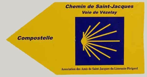
The signs are blue and yellow, with a stylised cockleshell and a broad arrow labelled ‘Compostelle’. Sometimes this is reduced to the broad arrow only. These routes are managed by the Association des Amis de Saint-Jacques.
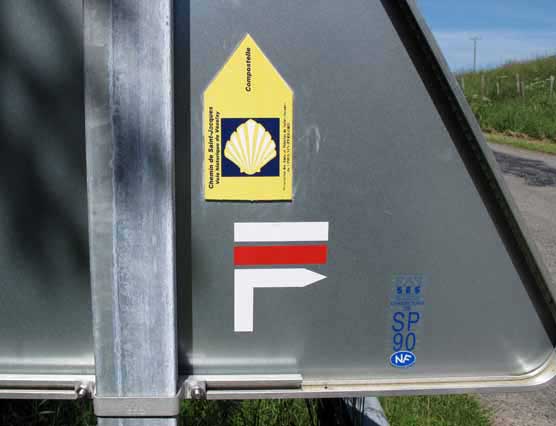
They often coincide with the GR, but seem to have a more determined attitude towards the goal of getting to Compostela.
They do not hesitate to use minor roads between villages rather than thrash about on circuitous tracks just to keep off the bitumen, as the GRs do.

Most walkers cut corners on the GR for this reason, especially in wet weather, when the GR is often a muddy trench.
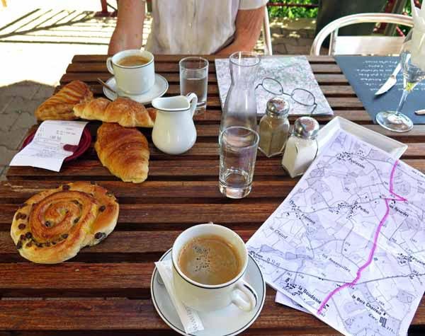
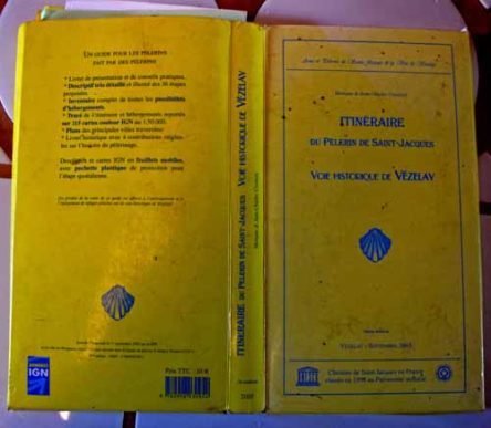
These pilgrim routes have a whole set of maps and guides of their own. The maps are on separate laminated pages in a folder and make up a block with the size and weight of a paving stone.
We find it best to refer to other people’s copies (for instance at night in a gîte), and write down a list of place names that the track passes through, which can then be found on the TOP100 map.
This ensures that you are not led astray, as we have been, by following pilgrim signs without knowing where they are heading.