The Way of St James (which translates as Chemin de Saint-Jacques-de-Compostelle in French, and as the Camino de Santiago in Spanish), is easily the most popular of the four traditional pilgrim routes.
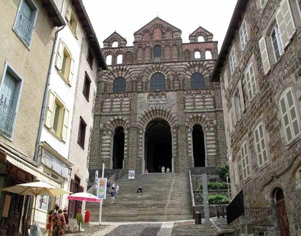
In terms of scenery it is also probably the most interesting, as it starts in the high plateau of the Massif Central at le Puy-en-Velay, with its treeless grasslands and drystone walls, then drops suddenly to follow the valley of the river Lot, where there is a succession of fairy-tale villages.
Crossing the Tarn and the Adour, the track enters the rich rolling expanses of Gascony and arrives at the Basque village of Saint-Jean-Pied-de-Port, the end of the French half of the pilgrimage. The traditional route has been approximately replicated by a marked pathway or Grande Randonnée (GR).
The Way of St James is the GR65, and there are three accompanying guide books put out by the French Walking Club, the Fédération Française de la Randonnée Pédestre, commonly known as the FFRP (see Maps and Guides).
There is also an alternative marked track, very similar to the GR65 but not identical, managed by the Amis de Saint Jacques, a religious organisation.
To get the maps and guides for these, it is necessary to acquire a créanciale (or crédentiale), a sort of religious passport, either from your local bishop or from a cathedral or Office of Tourism in France. The créanciale also entitles you to stay in special refuges.
These pilgrim refuges, called “gîtes d’étape” provide basic overnight accommodation and often a communal dinner as well. The food is plain but plentiful and the atmosphere around the table is usually very congenial.
Pilgrims can have their créanciale stamped with the name of the gîte, and leave comments in the “Livre d’Or” (book of gold).
An accommodation guide many people use is the strangely named “Miam-miam Dodo” (French baby talk for Eat-Sleep), which lists all the eating and sleeping possibilities along this pilgrimage.
It took us 31 days to do this walk.
Rocamadour variant
A popular variation of the Way of Le Puy diverges at Figeac and passes through the holy site of Rocamadour, rejoining the main track at la Romieu, but for complicated reasons, our version rejoined at Lauzerte. We took eight days to complete this detour.
Our route for this walk
The diary has been broken up into the following sections:
Le Puy-en-Velay to Aumont-Aubrac
Navarrenx to Saint-Jean-Pied-de-Port
Rocamadour Variant (Blue line)
Rocamadour to Tournon-d’Agenais
To see icons for each night’s accommodation on this map, press the full-screen symbol at the top right and then tick the accommodation icon box at the top left. Zoom in on a particular icon to see its precise location. These accommodation icons are also shown on all section maps.
You can also see this map using Google Earth and take a virtual flight along our route.