Saturday, 23 June 2012
Distance 22 km
Duration 6 hours 20 minutes
Ascent 826 m, descent 859 m
Map 164 of the TOP100 lime-green series
The camping ground was deep in frost and slumber as we huddled at a picnic table near the tent and spooned muesli between our chattering teeth.
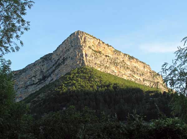
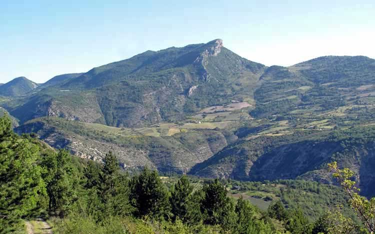
Above us loomed the great prow of the Rocher du Caire, one of the crags that make this area so popular with hang-gliders.
We left at seven o’clock in a clamour of church bells. Fortunately the entry gate of the camping ground was only half-closed, enough to prevent cars but not walkers from going through.
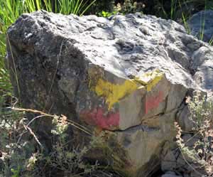
According to our map, the GRP (Tour des Baronnies) came through the village, crossed the bridge and continued for a while down the gorge, on the road that we had driven up in the school bus the evening before. This was confirmed by a yellow and red mark on the railing of the bridge, so we set off confidently.
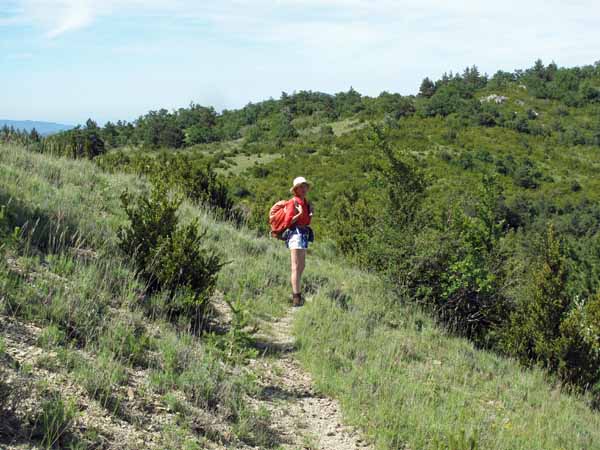
On both sides of the river the land rose in chaotic ridges and spurs, sometimes bare rock, sometimes clad in grasses and flowers, and the air was icy in the shadow of the mountains.
At least there was no traffic at that hour, but on the other hand, neither were there any GRP marks after the first one, which was slightly annoying.
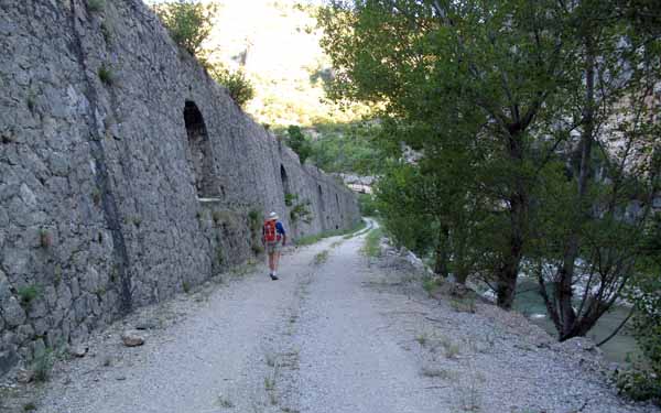
Before long we came to a road tunnel, so narrow that it had traffic lights to permit cars to take turns in the single lane. We did not enjoy the prospect of pressing ourselves against the tunnel wall if a car came past, but there seemed no alternative.
Then we noticed that there was a sandy wheel-track beside the tunnel, close to the river bank (possibly the original road), which we took gratefully.
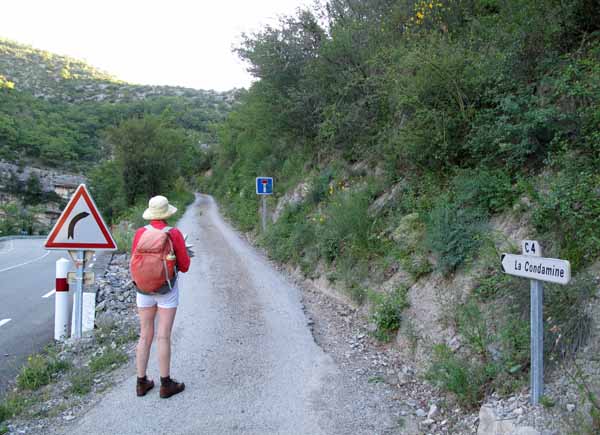
Just beyond the tunnel we saw a small, steep road (the C4 to la Condamine) switching back up the hillside.
There was no GRP turning sign but we decided to try it anyway, and as soon as we turned we saw the sign facing the other way.
The road was rough bitumen and at each hairpin bend a barricade of branches was all that prevented downhill traffic from plunging off into the ravine – not that there was any traffic.
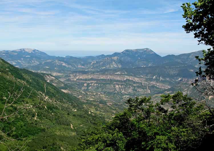
After a while the road flattened out and crossed a flowery meadow. All around us, near and far, were dry, scrubby conical peaks, some with projecting spurs of rock.
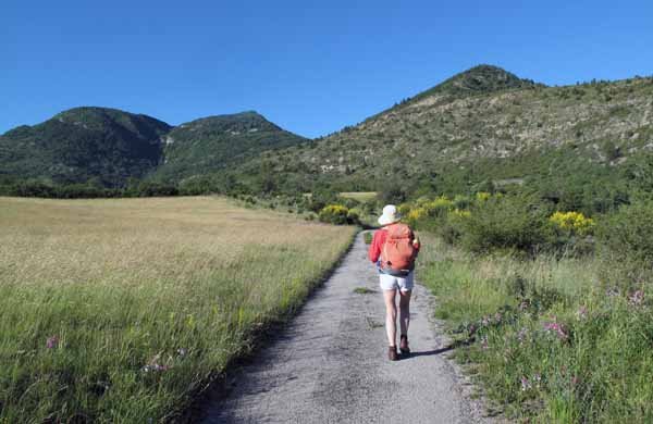
We passed a grove of cherry trees which we visited, filling our hats with the shiny red fruit to dip into as we walked.
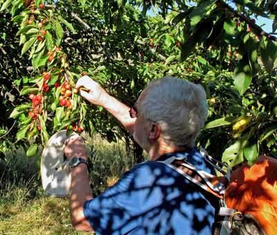
Soon the frantic barking of dogs warned us that we were near a farm, so we swallowed the last of the cherries, put our hats on, and approached.
The dogs became hysterical, but since they were tied up we did not need to get out the bag of tent poles to defend ourselves. Apart from them, there were no signs of life.
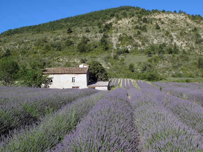
The farmhouse stood amongst cushiony rows of lavender, flowering but not yet harvested.
Here the road ended but a smart new yellow signpost pointed us along the wheel track beyond.
Soon we came to a fork, with one track going down towards a stream and the other up the slope.
Once again there was no turning sign, only a couple of red and yellow slashes painted ambiguously on a boulder, and we had to search along both branches, eventually finding another marker on the upper track.
After a long ascent through straggly forest on a series of hairpin bends, the road flattened out and we stopped to rest on a patch of soft grass among the pines (9 am).
The ground dropped away beside the track, down to the lavender farm and down again to the gorge where we had started.
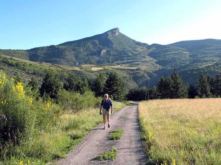
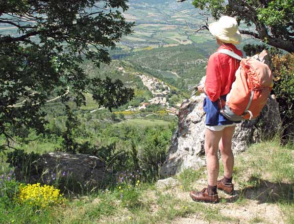
We looked across to the great crag that had previously towered over us but was now at eye level.
We had only gone a short way further when we came to an old fence line and noticed a parallel wheel track on our left which converged towards ours and joined it.
Just past the junction, the track started to descend steeply in zig-zags towards a new valley with villages and farms.
We checked the compass and realised that we were going north-west instead of south, so we hastily returned to the junction, where we searched but found no GRP sign of any sort, and certainly no indication of a turn.
However, the other track was going south, so we took it and after a while saw a faded GRP sign on a tree, which was a relief but did not lessen our indignation.
Although GRs and GRPs are marked on the TOP100 maps that we carry, there is not enough detail to negotiate a maze of forest tracks without signs. The scale is too small and most of the other tracks are not marked at all.
As we continued southward, there were several more unmarked forks, where we had to guess which way to go – fortunately correctly. It was a rare example of incompetent track-marking in France.
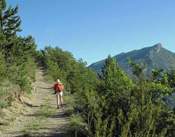
A long time later, the wheel track shrank to a path and began to climb ferociously. We hauled ourselves up by clutching exposed roots and overhanging branches, our faces almost touching the muddy slope, or cliff.
By the time the track flattened out we were exhausted, but at least there was a GRP marker there, plus a sign pointing up to the left to “Panorama”. We ignored this, but it gave us hope that we were not far from somewhere with more information.
And so it proved to be, although not before a considerable descent. The path came out of the forest to reveal a pleasant grassy expanse below us, dropping off on either side.
When we reached this place there was a spanking new yellow signpost declaring it the Col d’Ambonne, which was actually marked on our map, so we finally knew where we were.
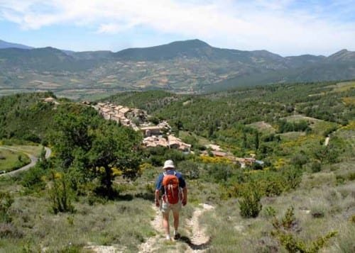
The post had arms sprouting in all directions and one of them said “Le Poët-Sigallat”, our immediate destination.
Looking at the map earlier, we had imagined that this village was near the top of a stiff climb, so we hesitated to take the downward path, but it turned that we had been reading the contours in reverse and it was actually at the bottom of a precipitous slope.
Our first sight of the place was as if from a plane. The path turned down a flowery hillside that became a wide white scree slope punctuated with twisted pines.
It was so steep that the stones beneath our feet rolled away as we stepped on them, so it was more like skiing than walking.
With great relief we arrived at the foot of the slope and entered the village, or hamlet. It was no more than a string of houses along a ridge, looping round the church square, with a road coming up from the valley.
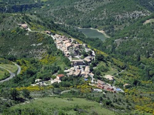
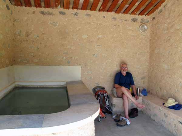
In the square was a newly renovated lavoir, with a stone bench inside, next to the water trough, and a fresh water tap outside.
It was blissful to sit there in the shade for a while drinking cool water, and although it was lunch time (1 pm) we were not hungry. A scrap of bread and cheese was all that we could manage.
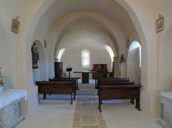
When our strength returned we strolled up the street, past the graveyard and into the church, which was simple and delightful.
For the remaining hour and a half of the day’s walk, we had little trouble following the GRP signs – this part of the track must have been maintained by a different group.
We left the village on a small local road that dropped away into the valley, where the GRP turned off and continued over a wooded ridge, then down a dirt road that led to the top of the village of Sainte-Jalle.
The day had heated up greatly since our frosty start at Rémuzat, and we were sweaty and fading fast by the time we trudged in.
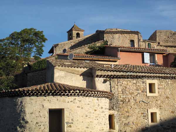
Sainte-Jalle was a much bigger place than le Poët-Sigallat, a haphazard mass of lanes and stairs on both sides of a tumbling stream. Ancient stone houses, a church, a few fig trees and the remains of a château were piled up against one another.
We passed a large old building, possibly part of the old château, which was now a luxurious holiday hotel, with deck chairs and umbrellas on a terrace hanging over the stream. This was all very well but there was no sign of the camping ground, nor of any shops.
The only people in sight were a group of locals sitting round a table in their tiny garden. When we asked about the camping ground, one of them exclaimed “Not here!”, which made us think for an awful moment that our information was wrong. But he only meant that it was in another part of the town, and he insisted on taking us there.
Although he was elderly and walked with a limp, he sprang along at a great pace, across the bridge, down various alleys and staircases, even through a tunnel, and brought us out on the main road, where a little group of shops adorned the bend.
There was an auberge which was closed, but he said it would open later. Pointing down an avenue of plane trees, he left us, and we went the last short distance to the camping ground.
As soon as we got there, we sank down in a grassy plot and fell asleep, overcome with weariness after a long, taxing first day on the track. I woke with a headache – no doubt from lack of caffeine – and crept over to have a shower and wash my clothes.
A group of old men in cloth caps and jackets were playing boules in the dust under the plane trees, a picture of contentment.
At about 6 pm we wandered back to the auberge and found it still closed, but next door an épicerie had opened. The woman there broke the shocking news that the auberge would be closed for the whole weekend, bringing on a little frenzy of buying on our part.
We collected a terrine, a camembert, a tomato, a bottle of wine and some apricots, grateful that we would not have to dine on muesli.
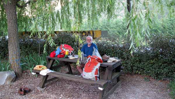
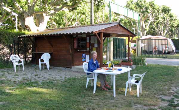
Back at the camping ground, which was full of big Dutch camper vans, the office/kiosk was now open and we paid our €9.40.
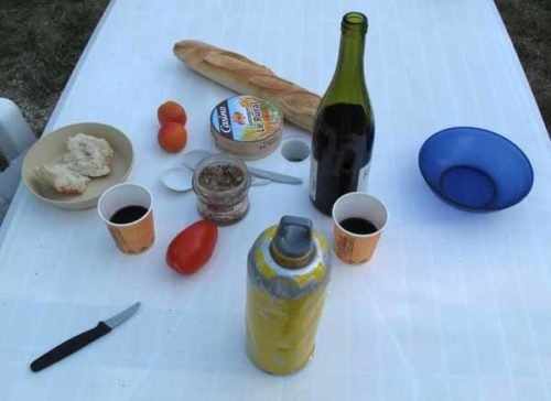
While we were there, we got two small plastic mugs of black coffee, which we drank at the nearby picnic table with the addition of some powdered milk. It was the first coffee to pass our lips that day and we really enjoyed it. My headache cleared immediately.
Later on we occupied the same table for our picnic dinner. The boules players had finished their game at last and were drinking at another table, but apart from them there were not many people about.
The occupants of the camper vans had already had their evening meal (they eat very early as a rule) and had withdrawn, presumably to watch television. Despite our afternoon sleep, we still felt exhausted, and soon retired to bed.