Sunday, 28 May 2023
Distance 22 km
Duration 7 hours 22 minutes
Ascent 111 m, descent 181 m
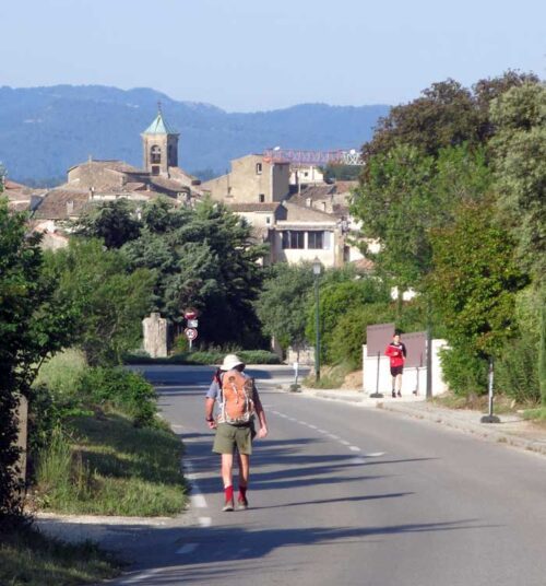
As we have done countless times in the past, we performed the miracle of getting our unruly scatter of possessions to vanish into our packs, but sadly, there was nobody about to admire the feat. Then, for the last time, we swung down the road towards the village and breakfast.
As we were crossing the ring road above the Place Barthélémy, a car suddenly swerved, mounted the kerb a little, and jolted to a stop. Out of the passenger window popped the head of Valérie, the angel of salvation from the pharmacy in Pertuis.
What a lovely surprise it was for us all, and we laughed at the unbelievable coincidence. She introduced us excitedly to her husband, who had heard the story and was equally delighted. Then, with kisses and handshakes all round, they sped off.
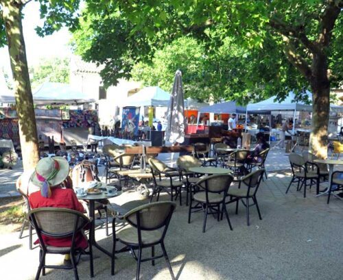
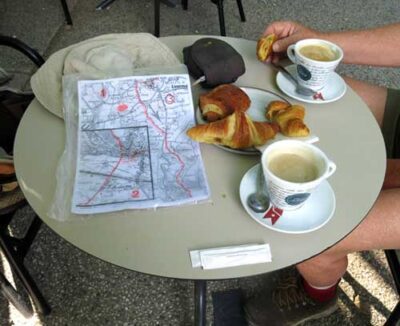
Breakfast under the green canopy outside the Comptoir, with a preliminary visit to the nearby Vival, was as much of a pleasure as yesterday. We felt strong and rested after our day’s pause, and confident that the walk to la Roque d’Anthéron would be no trouble.
Having strolled the short distance down to the château, we joined a PR, with its yellow markings, and continued to follow it along the road, down to an intersection with a simple wooden cross. We were conscious that the little cemetery nearby contained the bones of Albert Camus, the famous novelist, but we did not deviate to pay our respects.
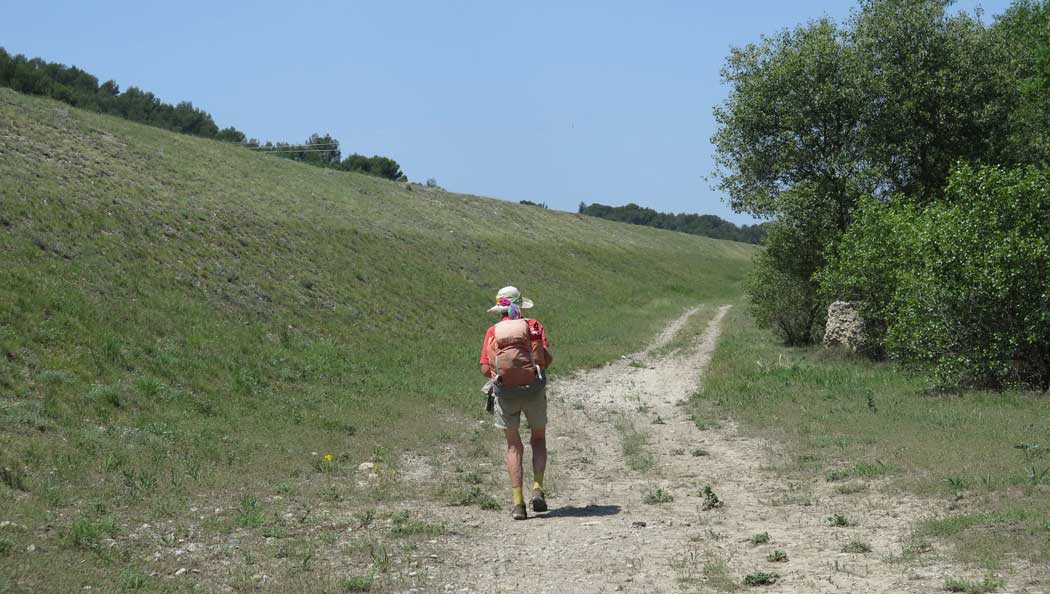
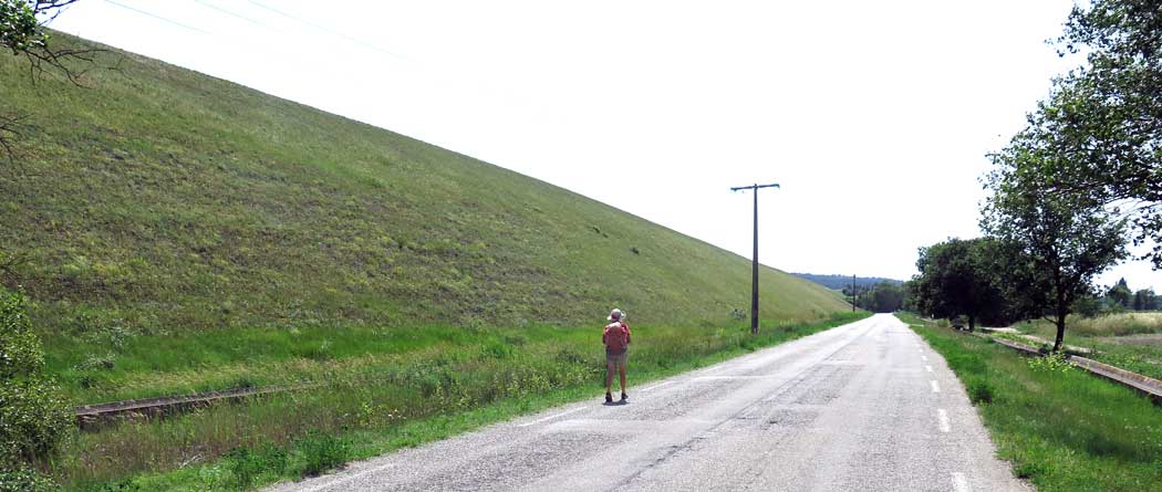
From the cross, we joined a much smaller rising road which soon became no more than a dirt wheel track. This was called the Draille de Lautin, a draille being a traditional route for animals to be driven to summer pastures and back.
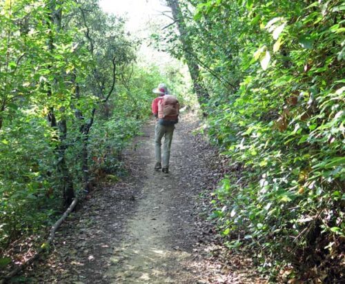
It climbed gently but steadily, past farms, many of which were planted with young grapevines, and eventually became no more than a foot track through the filtered green light of the deciduous forest
We felt as if we were back in the old, rural France that we so loved, and had had so conspicuously missed out on so far this year. It was a great pleasure, and gave us hope for the rest of our expedition.
We crossed the highway and kept climbing gradually through the forest, in which quite a few holiday houses were tucked, and eventually reached the top of the rise.
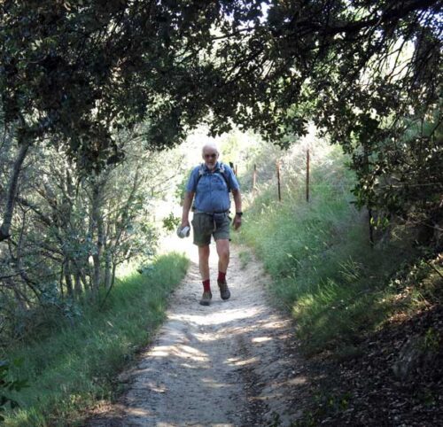
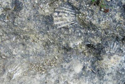
The descent into Cadenet was less easy, as the PR became steep, rough and rocky. The interesting thing was that the rocks that we were scrambling down were full of fossils of shells, reminding us that things were different a few million years ago.
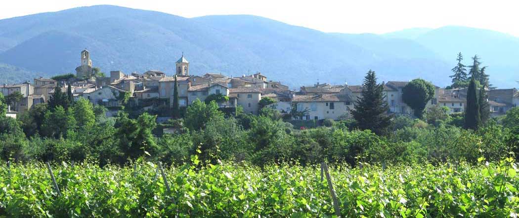
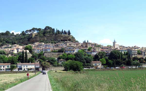
In due course we reached the first streets of Cadenet. The village clings to the edge of a considerable drop above flat alluvial fields, and the main street is a long descending zig-zag, with staircases joining one loop to the next.
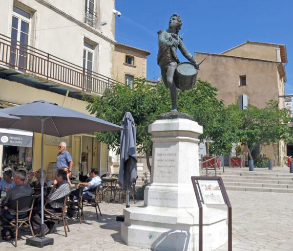
We walked along until we came to a square with trees and a couple of bars, and got a table in the shade next to a statue of a little drummer boy.
The story is that when the Nazis troops were retreating from France in 1944, they were stealing or destroying anything of value (not to mention killing as many inhabitants as they could), so this beloved little statue was taken down and hidden, only resuming its place in 1948.
After our refreshments, we took a steep staircase down to the flat land below and started walking through the grassy meadows, which were a mass of spring flowers, a beautiful sight.
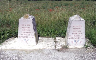
In the first few hundred metres we passed three memorials to young fellows who were assassinated by the Nazis, all on Bastille Day, 1944.
We were heading for the canal that we had last seen as we entered Oraison over a week ago. On the map it looked a simple matter to stroll along farm tracks to the highway (the D943), cross the Durance and then follow the canal as far as the camping ground.
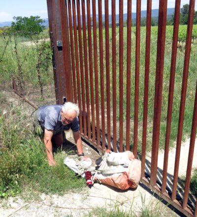
All went well until we were almost at the highway. We had passed the last farmhouse when we were confronted by a barbed-wire fence with an enormously high rusty gate that would have kept out Napoléon’s army, or Hitler’s for that matter.
However we noticed a small animal hole under the barbed wire and managed to wriggle through on our stomachs, very relieved that we did not have to go back. The concept of going back is something that we have great difficulty with.
We crossed the wide sandy Durance river on the highway bridge and shortly afterwards we turned off onto a scrubby track that went along below the great looming bulk of the canal.
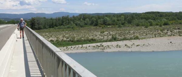
There was also a track on the top, beside the water of the canal, but that was treeless and stony and had official warning signs forbidding entry.
Months earlier, when we were planning the walk, we had mistaken this canal for a normal French one. Canals had always been a delight to walk beside, with their grassy banks covered in rushes and irises, and lines of huge plane trees like a guard of honour shading the towpath. There were locks, sometimes with a café attached, pleasure boats cruising past, and occasional villages.
This one was entirely different. It was was a twentieth-century construction and was built as a hydro-electric project, not for the transport of goods as the earlier ones were. It diverted water from the Durance river, and fed a series of hydro-electric power stations as it went down beside the river.
Between power stations it got higher and higher above the gently descending land around it, so that the water, when it fell through the turbines, would generate maximum power.
We had been warned on the first day of this walk, when we had struggled along the canal in the rain on our way to Oraison, but we had not understood the warning. We fondly imagined that it was just an inhospitable, treeless section of a normal canal, and I don’t remember wondering why it was so ridiculously high above its surroundings.
Probably we had other things to wonder about at the time, such as how to keep the map dry enough to be legible, and whether we were too soaking wet to camp that night.
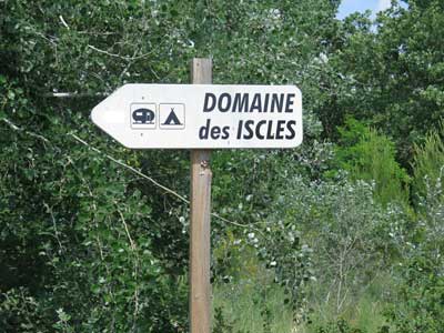
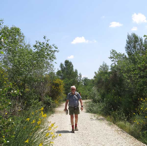
The dirt track went along through patches of gorse and poplar which afforded no shade, but it was easy enough. It seemed to go on for ever, with little to indicate where we were on the map, but eventually we emerged onto a bitumen road with a few buildings, and soon we saw the sign for the camping ground.
We hurried in, and the first thing we saw was an outdoor restaurant where a few people were just finishing their lunch (it was after 2 pm by then). Gleefully we joined them and managed to get a hot pizza.
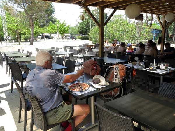
It was remarkable how many pizzas we had eaten so far on this trip, as pizza is usually the meal of last resort for us, but in this case it was a pleasant surprise..
The next thing was to go to the reception desk and book in for the night. Here we got another surprise, and not such a pleasant one.
In direct contradiction of the welcoming sign at the entrance, and for the second time this year, we were told that the camping ground did not accept tents, or even caravans and motorhomes!
The girl on the desk was apologetic, but those were the rules. However she did ring up another camping ground about ten kilometres further along, at Charleval, to check whether they would accept tents (they did), and she printed out a Google map for us to follow.
So instead of a fairly easy day, it turned into bit of an ordeal. We trudged along hot bitumen roads beside the rearing mass of the canal edge for a while, and then somehow managed to take a wrong turn and had to double back, which did not improve our mood.
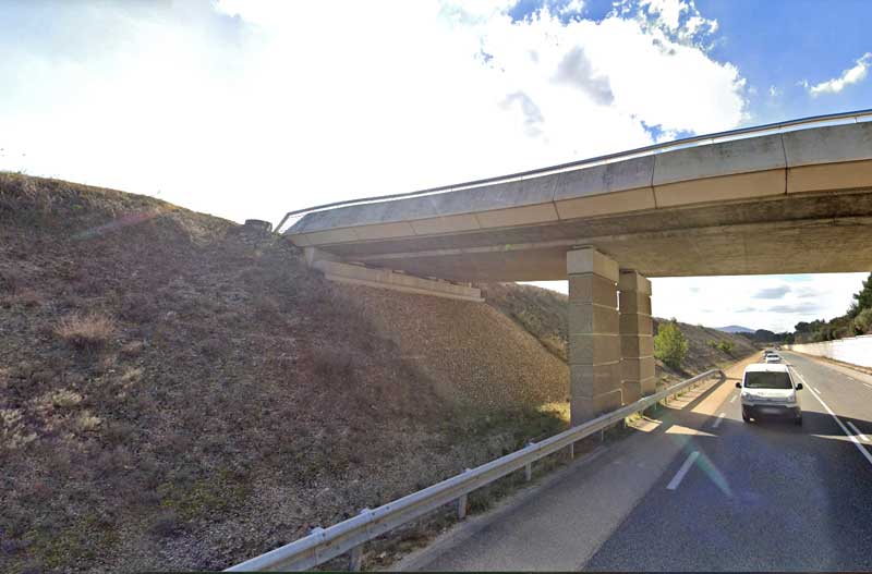
After a long time we came near to the village of Charleval, where the usual unsightly industrial sheds and scrap yards adorned the entry road. I looked at the map that we had been given, and thought I saw a shorter, easier way. There was an intersection on the highway ahead, which would take us straight into the camping ground.
So, disobeying Google, we continued along the highway. The road started to dip, but the surrounding land did not, and a nasty suspicion crept into our heads, soon confirmed.

The “intersection” was actually an overpass high above the highway, supported on one side by a vertical concrete wall, and on the other by a formidably steep slope consisting of smooth, rounded boulders cemented together.
It was the sort of thing that Keith has nightmares about, but the alternative was to retrace our steps for about two kilometres and take the longer way that Google had suggested.
Given our constitutional inability to take backward steps, we decided to give climbing a try. First I went up and dumped my pack on the top, beside the overpass, then I went down again, slung his pack over my shoulder, put an ineffectual hand under Keith’s armpit (which would not have slowed him down at all if he had fallen), and we slowly crept upwards.
A few cars honked from the highway below, presumably in amazement, or encouragement. Keith looked neither up nor down and, mastering his fear, concentrated his whole being on surmounting the boulder immediately in front of him.
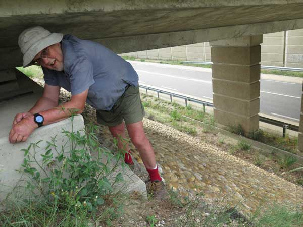
At last I told him that if he reached up, he would feel a protruding bolt (which was attached to the lower side of the overbridge). He grasped it and relief flooded into his face. After that he only needed to grab a second bolt and shuffle sideways onto the grassy slope near the top. It was his Finest Hour, without a doubt.
Exhausted, but exhilarated by this adventure, we were pleased that we did not have far to go to the camping ground. As we strolled in to the reception desk it began to rain and we thanked the merciful heavens that it had not begun while we were climbing the wall, as the wet boulders would have been impossibly slippery.
The camping area seemed to be fully occupied, so we felt lucky that we had a booking, which had been made by the apologetic girl at the previous unwelcoming camping ground.
Putting up the tent in the rain was not hard and took only a minute or two, after which we had hot showers, changed into our non-walking clothes and lay down for a richly-deserved nap.
Luckily, this camping ground, being fairly far from the centre of the village, had its own restaurant , but, strictly speaking, it was fully booked when we presented ourselves there.
Nevertheless, they managed to find us a table. It was almost in the entrance but we did not mind, and sat down gratefully.
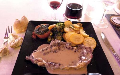
After a hard day of walking, it was inexpressibly pleasant to be sitting at our ease, with beautiful food being put in front of us and the table set with sparkling glasses and cutlery, in the typical French way.
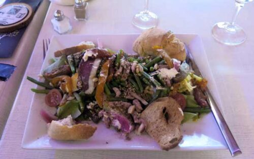
Keith had an entrecôte covered in Roquefort sauce, with crisp fried slices of potato and other vegetables, and I had a large salad.
The usual abundance of bread and wine rounded out a highly satisfactory meal, and we looked forward to an easier time in the next few days.
We were almost a third of the way through our planned walk and things were sure to improve.