Saturday, 20 May 2023
Distance 20 km
Duration 6 hours 45 minutes
Ascent 328 m, descent 422 m
During the 15 hours that we had slept without stirring, the rain had passed and the sky now had no more than a thin veil of cloud over it.
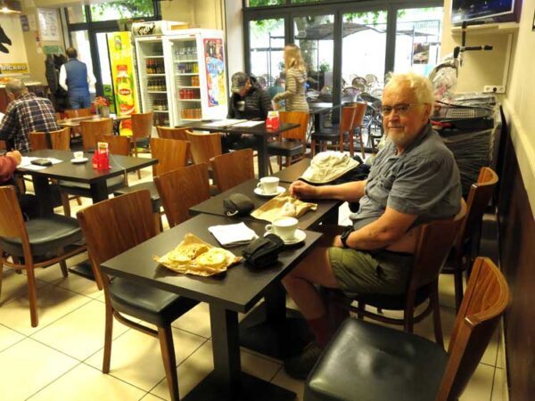
Even the tent was dry, so after leisurely showers, we packed up and strolled back through the quiet streets to the Place du Bourget, where the Café de l’Hôtel de Ville was already open.
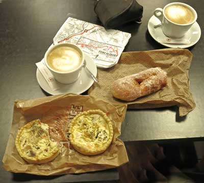
But before going in, we visited a boulangerie down the other side and, after surveying the many delightful offerings, chose a long sugary fritter and two small quiches, then returned to the café.
We went indoors, as the air was still cool. A few locals were crouched over newspapers and small black coffees, and we took our time with our gran’crèmes, our pastries and our maps. We felt that we were finally into the familiar rhythm of our previous walks, whereas the first couple of days had been a bit of a trial.
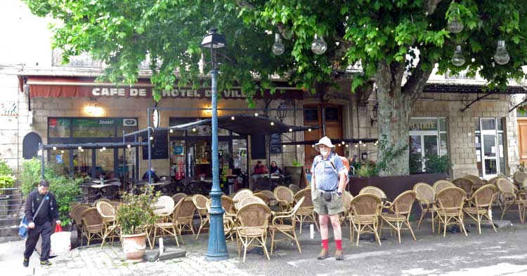
It was about 8 am when we set off in earnest. Luckily the first part was on a GR so we could pick the right descending street because of the red-and-white signs.
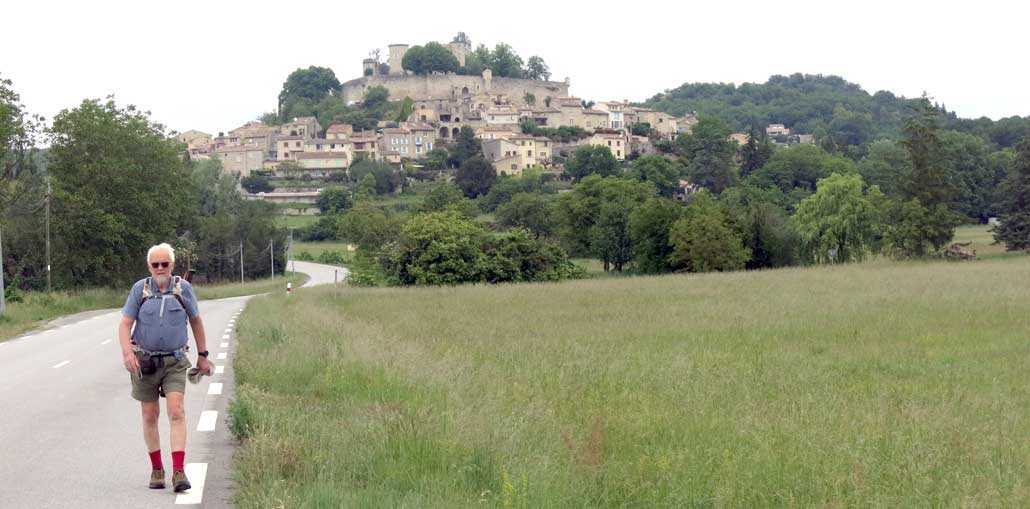
Once out of the houses the road continued steeply down, cutting through rocky outcrops and then levelling out as it approached the village of Mane.
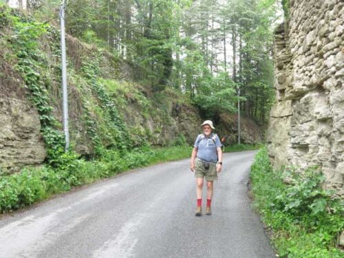
Our way was the old road, before it was supplanted by the D4100, and in places the bitumen had crumbled under the onslaught of weeds.
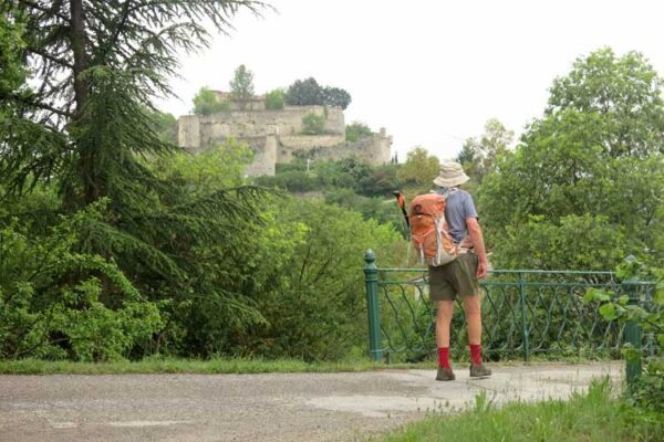
Above us loomed a steep domed hill on which crouched a very old-looking chateau or fortress.
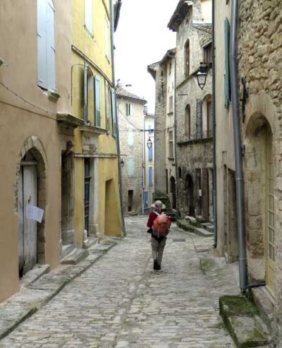
Once in the streets of the village, which were, crooked, narrow, cobbled, and lined with ancient stone houses, we asked a passing woman whether there was a bar here, and she replied proudly that there were two!
We stopped at the first one we came to and were soon comfortably seated in front of another round of coffee, only an hour after we had finished the first.
Everyone else in the place was a local, including the woman from whom we had asked directions.
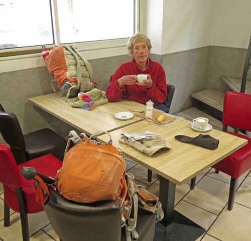
An old, trembling man arrived on a stick and was helped into a seat, whereupon he wordlessly gave some money to the waitress.
She came back with a glass of lemonade and a straw, asked him to open his purse, poured in the coins of change, then instructed him to close it and put it back in his pocket. It was an affecting display of community care in a small village.
We thought that before connecting with the small road that would take us to Dauphin, the next village, we needed to walk a little way on the dreaded D4100.
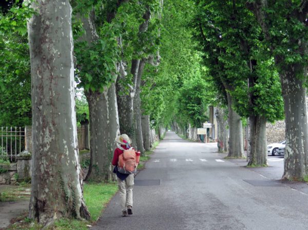
When we emerged from the café, we made a mistake. At this point it was a beautiful classic old French highway, lined on both sides with lines of age-old plane trees which formed a green tunnel stretching into the distance.
We marched along confidently for a while, until it became clear that the expected turn-off was not going to appear (we must have gone past it as we left the bar) .
It would have been better to continue along the D4100 until the next turn-off, but we were not quite sure where we were on the map, so we retreated to the bar and took the side road there.
This was the right thing to do but, unhappily for us, we could not find our way through the carpark and the various sports pavilions to the little road that we were looking for, so we ended up plodding along a fairly busy road (the D13) for a couple of kilometres until the elusive small road sneaked in from the right.
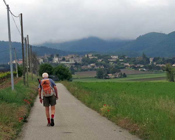
The redeeming feature of this mistake was that we had a very good view back to Mane, a dome of houses rising abruptly out of the fields, dominated, rather menacingly, by the chateau, with its encircling fortress wall.
Almost as soon as the small road joined us, we made a right turn, then a left one and started climbing towards Dauphin, which was spread out along a high ridge above us.
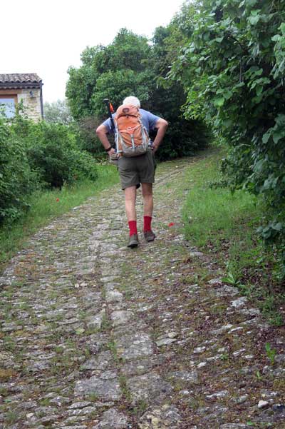
The road was easy enough, and devoid of cars. Near the top it became much steeper, but we had the pleasure of going up a section of the old cobbled way, which was in remarkably good condition.
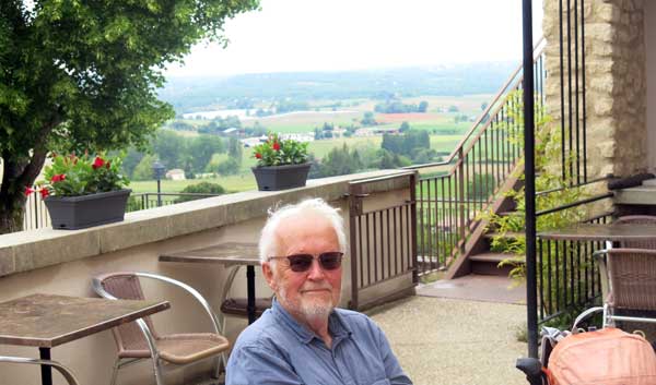
Emerging onto a street, we walked a short way until we came to a bar, hanging over the void like all the houses near it. Inside it was a busy scene, as they were setting up for a big birthday lunch and the place was about to close to the public.
However the kind hostess allowed us to sit outside and have coffee (we did not mention that it was the third bar that we had enjoyed this morning). The terrace had a dizzying view of the whole landscape to the east stretching away into the haze.
Continuing along the street, we descended to the left and found ourselves on the D5, the main road over the distant mountain range in front of us.
We could see from the map that this road writhed and twisted dramatically when it got to the steep approach to the saddle, but we planned to take an old forestry road which, although steeper, was less than half as long.
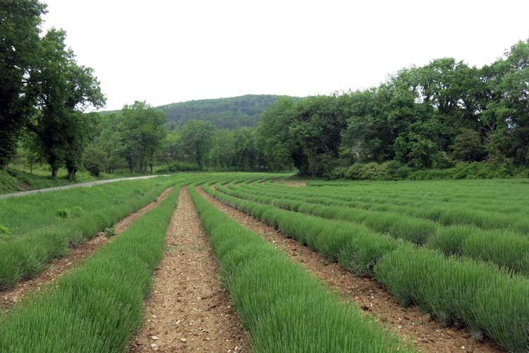
At first the road was fairly flat, with well-tended lavender farms beside it, and we admired their graceful curves.
Beyond that we came to a place that looked like an industrial rubbish dump but was actually a series of gas wells. This was where the steep ascent began, and the parting of the ways of the serpentine public road and the direct forestry track.
At this point Keith was feeling very tired (the effect of the pills that he was taking), so we sat down under a tree and rested for a while, but things did not improve, so we reluctantly decided to go the long, gentle way on the bitumen, rather than the short, stony, steep way.
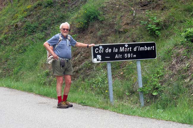
It turned out not to be as tedious as we had expected, and on the way to the Col de la Mort d’Imbert, we wondered about this strange name. We guessed that it was named in memory of a Tour de France rider who had come to grief on this pass, but later we heard a much older and more colourful explanation.
Long, long ago, there was a village on the road between Manosque and the pass, and the innkeeper’s daughter, whose name was Laure, was a legendary beauty.
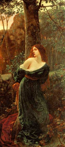
Every man who saw her fell in love with her flawless face and long, dark hair, including the fat, middle-aged village idiot, who pestered her every day. However, she loved a predictably handsome, rich young man, and on the day that she married him, the village idiot (whose name was Imbert) flew into a jealous rage and abducted her, dragging her up into the wild forest above the village, where he hid her in a derelict farmhouse.
Despite his attempts to ravish her, she somehow resisted for several days, until the new husband found out where she was and came to the rescue. In the ensuing fight, Imbert proved to be stronger than he looked and was about to overpower the young man when Laure, armed with a kitchen knife, plunged it into Imbert’s back and killed him instantly. So goes the story.
When we reached the col, there was nothing except a road sign to mark it, but the descent was much more enjoyable the the climb.
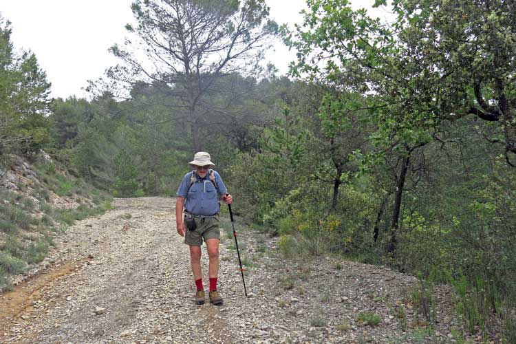
Not only because it was downhill, but because there was a wide, gravelly track, possibly an old main road, descending swiftly through the forest. It is now favoured by bike riders, several of whom demonstrated their complete lack of fear by hurtling past us airborne, after politely shouting a warning.
Gradually the land levelled out and we joined a bitumen road, and then we were among the houses of Manosque.
It began to rain, mistily at first but then heavily, so that we had to struggle into our white capes.
When we got to the road that encircles the old walled town, the prospect of trudging another kilometre and a half to the camping ground, and then putting up the tent in the rain, did not appeal, so we decided to look for a hotel.
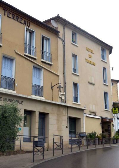
With the aid of a shopkeeper, who consulted his phone, we found that the local Logis hotel was just nearby – the Hotel Terreau. It was beside the police station and had a very narrow frontage. Most of the rooms, including ours, were actually above the police station, which surely would make even the most nervous guest feel safe.
We looked forward to a happy evening in the old town, remembering what a lovely place it had been when we were last here in 2007.
Having had showers and put on our “evening clothes” (in my case, the only change was a clean white shirt), we walked across the carpark to one of the arched entrances in the huge encircling wall. Inside, instead of the lively, welcoming scene that we remembered, it was almost deserted except for a few lonely bars.
The cobbled lanes were dark with rainwater and the open place next to the church, where we had previously eaten a glorious lunch, was silent and empty. It was a great disappointment.
The only slightly redeeming feature was that we saw the childhood home of Jean Giono, the famous novelist who had lived all his life in Manosque and whose works are imbued with pacifism and love of nature.
We had noticed quotes from Jean Giono’s writings on the risers of the stairs in the hotel, so it was evident that the town was very proud of him.
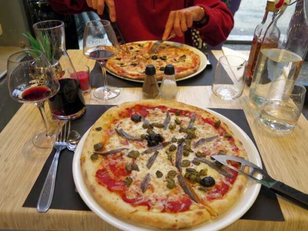
Retreating from the dreary lanes of the old town, we went out onto the modern street and found a big, cheerful pizzeria full of lights and people, where we had pizzas and wine, and enjoyed it greatly.
We only had to cross the road to arrive back at our hotel and use the “access de nuit”, which was a door on the other side of the police station which led up some stairs, then across to the bedrooms of the hotel.
Previous day: Oraison to Forcalquier