One of the four traditional pilgrim routes, the Way of Vézelay (Via Lemovicensis) was used by pilgrims coming from north-eastern France, Germany and Belgium. The Latin name refers to Limoges, one of the most important pilgrim sites along the way.
The traditional route has been approximately replicated by a marked pathway or Grande Randonnée (GR654) as far as Saint-Astier. From there the GR654 deviates south through Bergerac to meet the Way of Le Puy (GR65) at Montréal-du-Gers.
There is an accompanying guide book, Sentier vers Saint-Jacques-de-Compostelle via Vézelay put out by the French Walking Club, the Fédération Française de la Randonnée Pédestre, commonly known as the FFRP (see Maps and Guides).
There is also an alternative marked track, very similar to the GR654 but not identical, managed by the Amis de Saint Jacques, a religious organisation. After Saint-Astier this track continues on the more direct and traditional route towards Mont de Marsan and the Spanish border.
Maps and guides (in French) are available from Amis de Saint Jacques. A guide to this walk in English can be obtained from the Dutch Association of St James.
On pilgrim routes, special refuges (gîtes d’étapes) provide basic overnight accommodation and often a communal dinner as well. To stay in these refuges, it is necessary to acquire a créanciale (or crédentiale), a sort of religious passport, either from your local bishop or from a cathedral or Office of Tourism in France.
The food is plain but plentiful and the atmosphere around the table is usually very congenial. Pilgrims can have their créanciale stamped with the name of the gîte, and can leave comments in the “Livre d’Or” (the book of gold).
An accommodation guide is the strangely named “Miam-miam Dodo” (French baby talk for Eat-Sleep), which lists all the eating and sleeping possibilities along this pilgrimage.
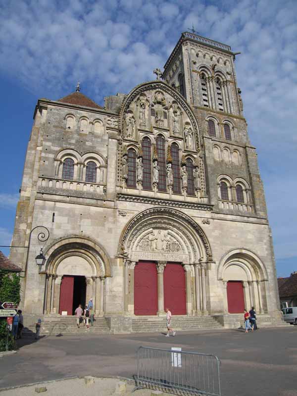
The traditional starting point is the great abbey of Vézelay, although many northern pilgrims walk all the way from their front door. We had been to Vézelay in 2006 and had walked to the Loire from there, but by a very circuitous route through Chablis and Auxerre.
It was only after we left Clamecy that we came close to the pilgrimage, and even then it was not the usual route, as we hit the Loire at Cosne-sur-Loire rather than at la Charité-sur-Loire.
The first section of this account describes three days of that 2006 walk and the subsequent sections are of our walk in 2010.
On the whole we followed the route marked out for the religious pilgrims, which tended to be more direct than the GR654.
However, at Saint-Astier we transferred our allegiance to the GR and kept in contact with it through Bergerac, joining the main pilgrim route, the Way of Le Puy (GR65) at Condom.
We would have stuck more closely to it if the weather had not been so inclement. It took us 31 days to do this walk.
Although this was the end of the GR654, we continued another two days and ended up at Auch on the Way of Arles (GR653). This deviation is popular with pilgrims who want to visit Lourdes on their way to Compostela.
Because the walk described above did not start in Vézelay, more recently (in 2018) we repaired this omission by walking from Sancoins to Vézelay, a reverse version of the first seven days of the pilgrimage. The route of this walk is shown in purple on the map below.
Our route for this walk
The diary has been broken up into the following sections:
Cosne-sur-Loire to Fourchambault
Fourchambault to Loye-sur-Arnon
Bénévent-l’Abbaye to Flavignac
Bergerac to Castelmoron-sur-Lot
Sancoins to Vézelay Variant (Purple line)
To see icons for each night’s accommodation on this map, press the full-screen symbol at the top right and then tick the accommodation icon box at the top left. Zoom in on a particular icon to see its precise location. These accommodation icons are also shown on all section maps.
You can also see this map using Google Earth and take a virtual flight along our route.