Monday, 23 June 2003
Distance 11 km
Duration 4 hours 50 minutes
Ascent 1243 m, descent 266 m
Map 69 of the TOP100 blue series (now superseded)
Topoguide (ref. 1086) Pyrénées Occidentales
We woke enveloped in mist but decided to take the high route anyway and hope for it to dissipate, rather than plod around to Arette on the road. We set off just before 7 am and started climbing immediately, on a footpath through a wood.
Soon we were in a deep, steep ravine full of ferns and mossy logs, then on an ancient cobbled way that zig-zagged up in the forest, getting steeper all the time until it was more of a staircase than a track. Our progress was hindered by recent bulldozing which had obliterated parts of the track.
At last we rose above the treeline into an alpine meadow and came to the ruins of a shepherd’s hut, where we sat down gratefully for refreshment (bread and sardines).
It was becoming obvious that we were carrying too much weight for the Pyrenees, especially as we were hardly using our camping gear. While we sat there the mist began to thicken, rolling up from the forest to blot out even the closest marker posts.
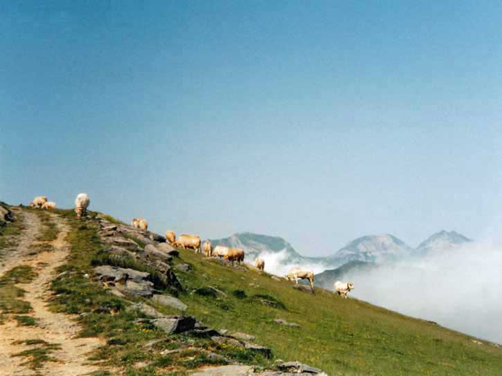
This was slightly alarming but we pressed on and had no trouble following the well-trodden track. We could hear bells in the mist and after a while we found a flock of black-legged sheep milling about a water trough. The well-trodden track multiplied into many, but a GR sign showed us the way.
At the second trough it was a different story, as we failed to see the inconspicuous GR turning sign just before it. After following many false trails we finally noticed a flash of red and white, and soon afterwards found ourselves on a stony wheel-track, which took us all the way to the col.
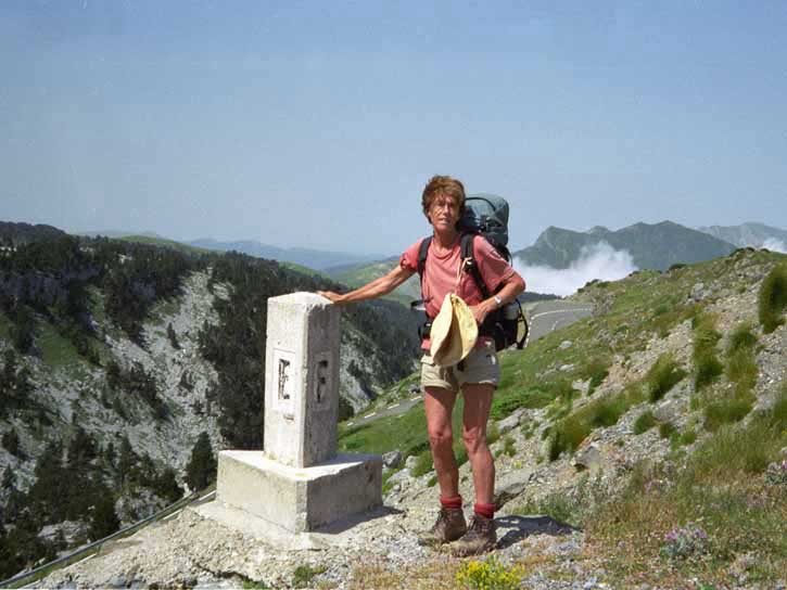
The mist began to break up and pale, jagged peaks appeared. At the top we looked into Spain, a wasteland of broken white rock and black pines.
The col is named for the boundary stone, dedicated to Saint Martin, which was the site of an ancient cross-border ritual, the Junte of Roncal, in which three cows were given every year by the French side to the Spanish, in exchange for access to water.
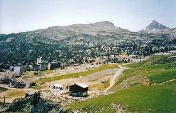
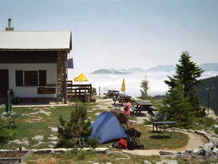
The bitumen road descends to the ski-station, but we followed the GR down over springy turf and quickly reached the refuge, which was above the station on a rocky ledge. The walls were two feet thick and the roof was held down by steel cables. All around were sharp peaks, and below our feet was the ugly scar of the ski-station.
Our host, the kind and courteous Jean, welcomed us with a formal handshake and said we could camp on his little lawn, only paying €1.50 each for a shower.
Our first coffee of the day was enjoyed under a cheerful yellow umbrella, just before it turned inside out as a breeze sprang up. The only other guest was a French girl with a sprained ankle.
As the afternoon progressed, it dawned on us that our companions from last night were not coming. Jean said he had seen two walkers, one limping, going very slowly up the road about midday. They must have taken the road, which is very short, and pushed on to Lescun the same day.
We were astonished to find Richard’s name in the house-book for the evening before. He was a much slower walker than any of us, so we deduced that he had taken the road all the way from Logibar, or even hitch-hiked, the ultimate shameful act.
At dinner we shared a table with a charming father and son from Cognac, here to climb the Pic d’Anie in the morning. It only takes three hours, apparently. This time we spoke French. The father has seven adult children, but only one is keen on mountains.
Our host and his third wife, a graceful creature called Claire, sat at an adjoining table and Claire told us about her garden in Oloron, obviously a great pleasure to her.
The meal started with salads from this garden and Béarnaise paté, then progressed to duck (also their own produce), pale local cheese and chocolate mousse. The wine was also local. After coffee we retired to the tent.
About midnight, lightning from storms in Spain, reflected on the clouds, made a constant silent flickering. Later the thunder arrived, accompanied by rain and a strengthening wind. Soon it was roaring around the tent, cracking the fly like a whip and threatening to snatch the whole thing, us included, off the ledge.
We decided to retreat to the refuge, but before Keith had finished carrying the packs over, the tent gave way, enshrouding me in loose wet cloth. I struggled out and we somehow dragged the whole mass across to the door, fell inside and forced it shut. The true meaning of the word ‘refuge’ was clear to us at that moment. Then Keith very bravely went out into the howling night and retrieved some things we had dropped, including one of his boots, his sleeping bag and my hat.
Our host came down the stairs in a fetching nightie and head torch and showed us the emergency room, where we spent the rest of the night in grateful peace.